Unsettled Weather Ahead...
STORMY WEAHTER AHEAD…
Each and every day over the next few days will feature storm chances. Friday will be the day with the most widespread storms and severe weather.
THIS EVENING…
The dryline has set up just west of Abilene, Jacksboro and Montague. Storms are possible along this dryline into western Oklahoma. If storms develop they will likely be severe. These may affect our far northwest counties like Jack, Montague, and maybe even Cooke Co. In the metroplex, there is a very small chance of a pop up shower or thunderstorms this evening, but most areas will stay dry. It will be warm and muggy tonight with a low of only 71 degrees.
THURSDAY…
Thursday will be much like today with cloudy skies in the morning then partly sunny in the afternoon. The dryline will once again be located to our west. Storms are possible along the dryline tomorrow with these storms being severe. Again our northwestern counties will have the best chance of storms in the afternoon and evening. There could be a few storms that develop closer to the metroplex in the afternoon and evening, but rain chances are around 30% on Thursday for the DFW area. The western sections of North Texas are under the slight risk for severe weather on Thursday.
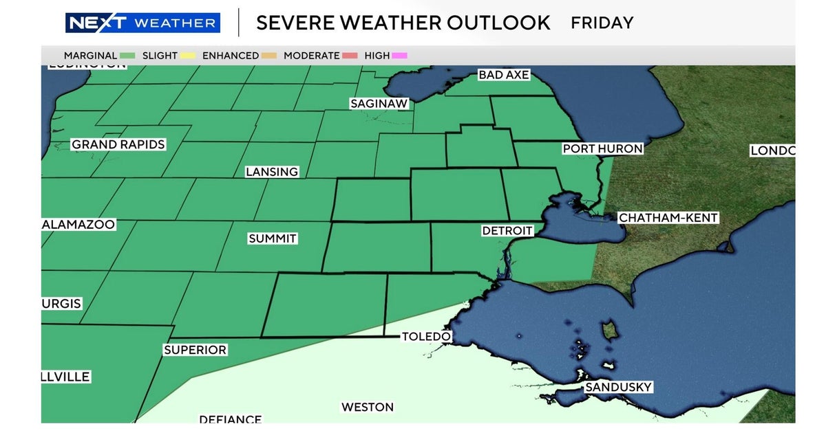
FRIDAY…
The severe threat for Friday includes all of North Texas. A Pacific cold front will slide into the area and showers and thunderstorms will likely get going in the morning and continue into the afternoon. Severe weather will be likely with large hail and damaging winds. A few tornadoes will be possible as some supercells will be likely. The tornado threat is not terrible high, but a few storms could produce a tornado. As you can see below the slight risk includes all of North Texas for Friday.
WHY SO STORMY…
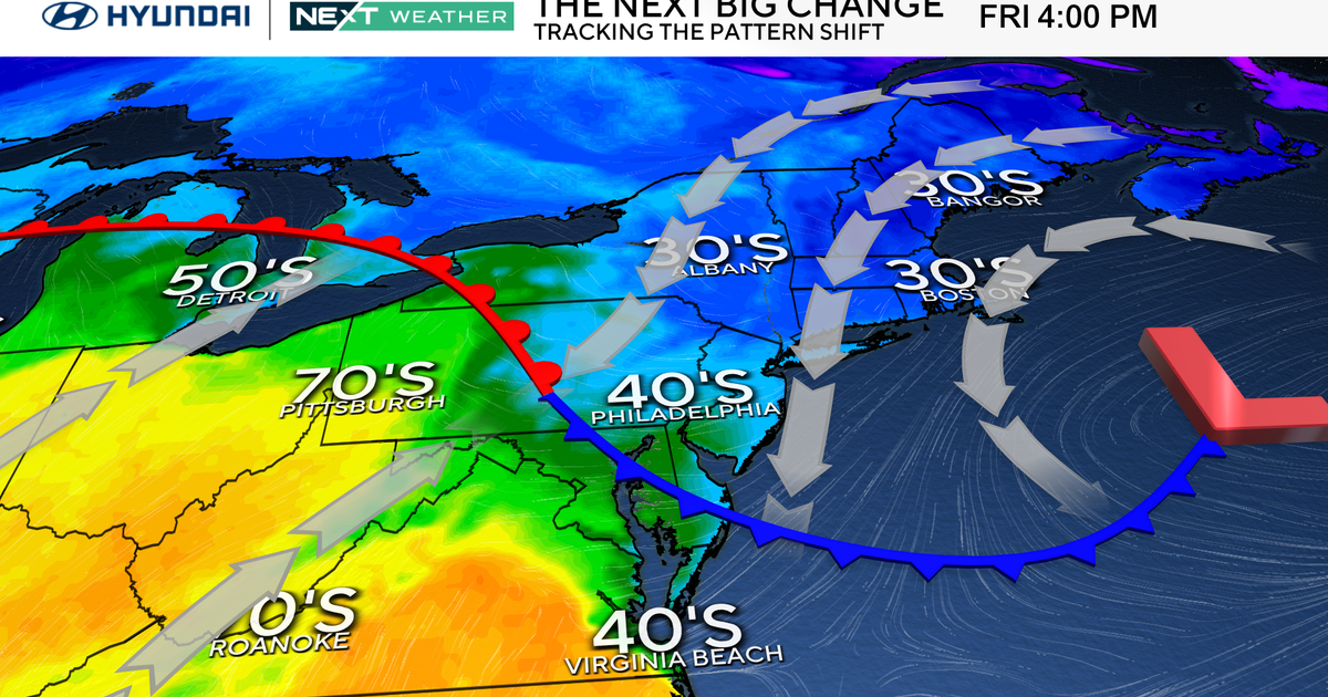
A very unsettled upper level pattern has set up across the country and that pattern looks like it will hold for at least the next 7 days. There is a large upper level low spinning over the western part of the US with another upper level low spinning in the eastern part of the country. The main Jetstream to get these lows moving is up into Canada. So these upper level lows are basically stuck rotating around in the same area. Strong disturbances rotate around these upper level systems. Look at the yellow area shown on the map below. (text continued below)
This is the 500mb flow for Friday evening. Note the yellow area moving over West Texas. This is the upper level disturbance rotating around the low which is over Wyoming (the closed loop labeled 564). Upper level disturbances like this will continue to get close to Texas on Sunday, Monday, Tuesday and Wednesday of next week. It appears Friday's setup will be the most significant for widespread storms, but even on Saturday rain coverage will approach 40%.
Sunday thru Tuesday of next week, the focus of storms will shift to the dryline mainly in western sections of North Texas. That would leave us in the metroplex stuck with warm and muggy air with temperatures around 90 degrees each day. Wednesday of next week could see another decent round of storms.