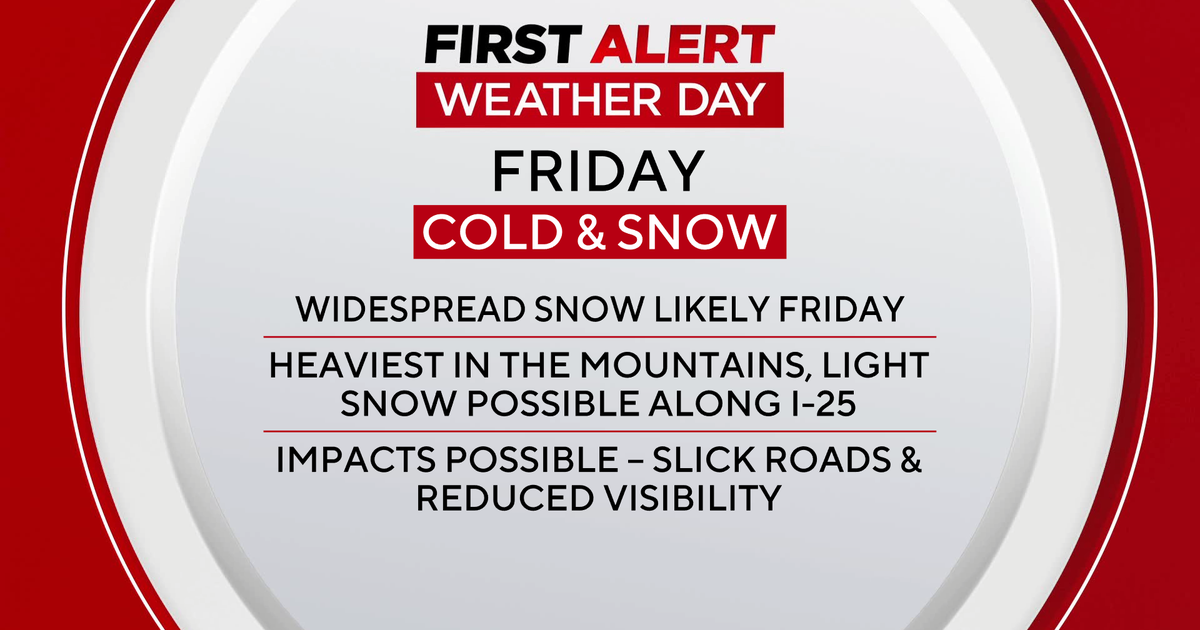
Strong Storms Rolling Through North Texas
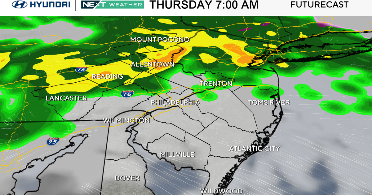
FORT WORTH (CBSDFW.COM) - Scattered showers and thundershowers have already initiated across the Metroplex on Friday morning, with the main storm line moving out of the Abilene area and heading toward North Texas. As anticipated, that main line is becoming broken, which will allow breaks from the rain and some sunshine as it moves toward the Metroplex. That sunshine will help to enhance storms along the line during the midday hours, as it moves over Fort Worth and Dallas.
For the remainder of Friday morning, expect hit-and-miss showers and thundershowers for most of North Texas along the Interstate-35 corridor and areas to the west.
We are still on track for strong-to-severe storms on Friday afternoon for areas along the Interstate-35 corridor and areas to the east. The main storms threats will be damaging winds, deadly lightning and large hail. As the storms transition east of the Interstate-35 corridor, a small tornado threat will exist with individual storm cells.
The main storm line should impact the metropolitan area between 1:00 p.m. and 7:00 p.m. on Friday.