Severe Weather Update
Severe weather has cleared the Metroplex as the cold front responsible for our severe weather is now east of DFW. A Thunderstorm Watch continues along and east of the front where T'Storm Warnings continue:
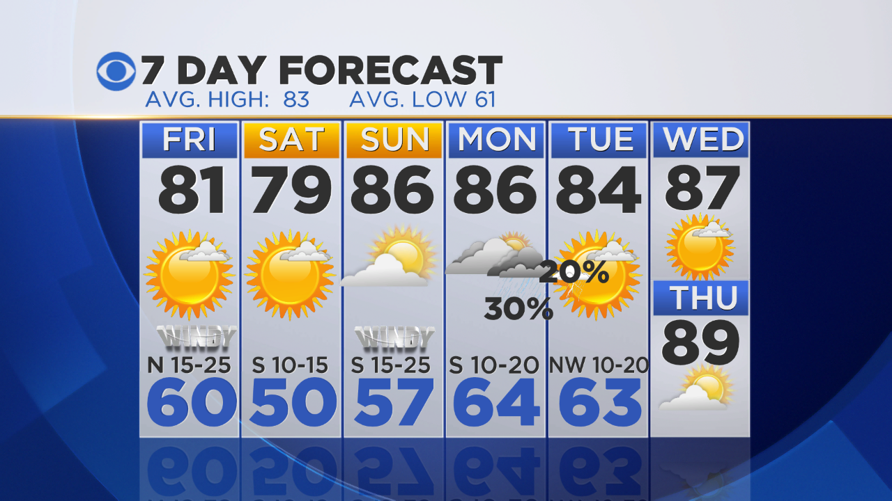
With the strong northwest winds going on over Fort Worth and Dallas the temperatures are going to be much cooler heading into the weekend. Today DFW hit 95° just before the storms hit. Tomorrow we'll be in the low 80's:
The weekend looks great. Low humidity on Saturday teamed with a northwest wind means a very cold morning, certainly the coldest since early mid-May:
Saturday's high will only be in the 70's. A south wind will push the highs back into the 80's on Sunday. We have another rain chance on Monday and Tuesday:
Video and pictures from the extensive wind damage from today's storms can be found on the main page of CBSDFW.com. . Nice to know the weather will stay peaceful for the weekend as clean up begins.


