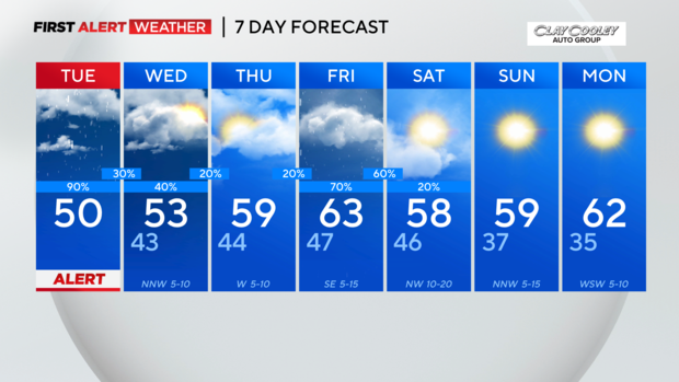
Scattered showers, isolated storms roll in Tuesday
NORTH TEXAS – We're tracking more rain in your First Alert Forecast.
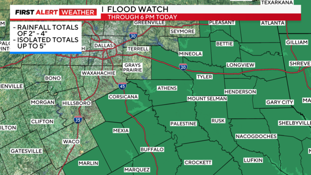
A flood watch is in effect for our counties southeast of metroplex until 6 p.m. Tuesday. Those counties include Anderson, Henderson, Navarro and Van Zandt. Areas under the watch could see between two and four inches of rain with a few isolated higher amounts.
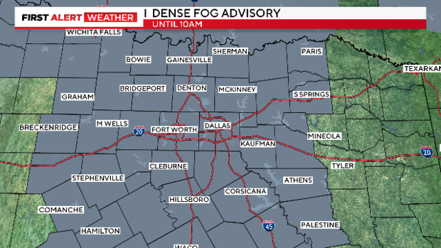
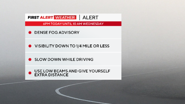
High temperatures will be near the low 50s. Lows will be in the lower 40s. A few showers are possible early. Otherwise, we'll be dealing with another round of dense fog overnight.
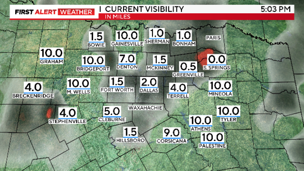
The NWS issued a dense fog advisory that goes into effect at 6 p.m. In some spots, visibility is down to less than 0.25 miles with Sulphur Springs reporting 0.0 miles in visibility as of 5:00 pm.
On Wednesday, we'll start the day with areas of dense fog in North Texas. We'll also be tracking a few scattered showers (40% chance). Highs will be in the lower 50s.
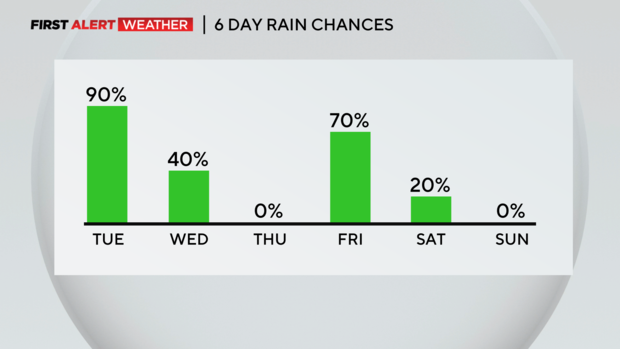
We'll get a bit of a break from the rain on Thursday with partly sunny skies. Highs will be in the upper 50s to near 60 degrees.
Rain and storms return for Friday and some of the rain could be heavy at times. The chance for rain is at 70%. Highs will be in the lower 60s.
This weekend will be a bit cooler, reaching the upper 50s for both Saturday and Sunday.