Severe thunderstorm watch canceled for most of North Texas

NORTH TEXAS – A large portion of the severe thunderstorm watch has been canceled for North Texas.
The severe threat has shifted to the southeast. Kaufman County, Navarro County and counties east-southeast remain in the severe thunderstorm watch until 10 p.m.
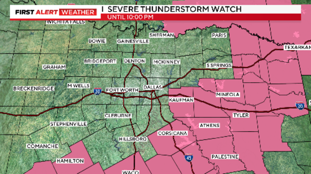
Originally, the severe thunderstorm watch had been issued until 11 p.m. for most of North Texas. The watch included the Dallas-Fort Worth Metroplex.
Major threats included the potential of very large hail and damaging winds.
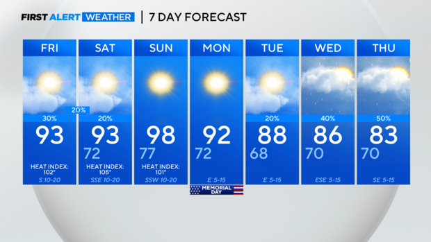
Friday's high temperature of 92 was 4 degrees shy of tying a record set in 1996.
Meanwhile, Saturday will be hot and humid with highs in the lower 90s and "feels-like" temperatures around 103 degrees.
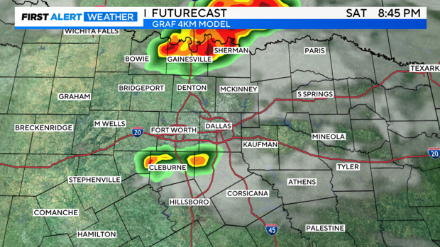
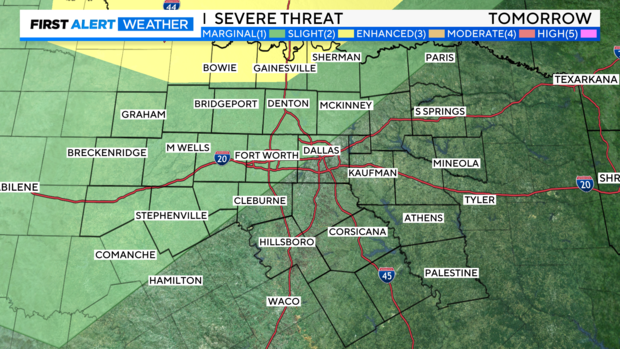
A few storms are possible Saturday evening, mainly along the Red River. The storms could also become severe with large hail and damaging winds.
Sunday looks to be our hottest day of the holiday weekend, with temperatures in the upper 90s. The forecasted high temperature is 98, just short of the record 99 degrees set in 1980.
Luckily, a cold front moves in late Sunday. Cooler and drier air will return to the region, resulting in a less humid Memorial Day.
Rain and storm chances will ramp back up heading into the middle of the week.