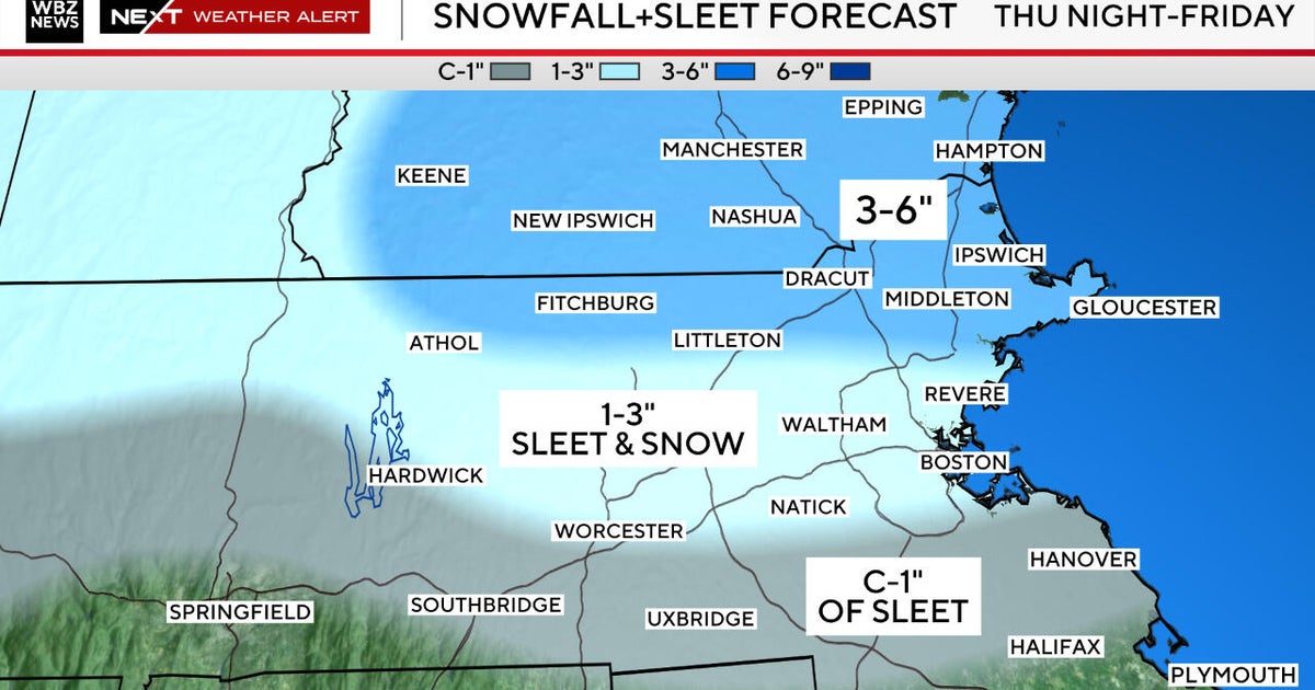
Isolated Storms Today...Better Chance This Weekend
We had quite an active weather evening in North Texas Wednesday. Several reports of hail and wind damage, especially north of I-20. Rainfall wasn't tremendously impressive, but every drop helps. Here's a look at Wednesday's rainfall.
We have seen few showers & storms during the morning hours Thursday...they have not been severe, but just "splash-n-dash" type showers. We'll see a few isolated storms throughout the afternoon...the favored area for this activity overall will be north and east of the DFW area. But it won't be as widespread as yesterday's activity.
Here's the 1pm FutureSky Forecast:
3pm FutureSky Forecast
6pm FutureSky Forecast
There is another risk for a severe outbreak, primarily in the central part of the United States. The strongest risk for tornadoes exists today across central and eastern Oklahoma. The SLIGHT RISK area does include our far northern counties if a storm can form there.
Friday should be dry in North Texas with temperatures back in the 90s! By Saturday, a weak cold front will be moving in from the north and will help trigger scattered showers and thunderstorms. Some of the storms Saturday afternoon and evening could be severe with large hail and damaging wind.
Noon Saturday FutureSky Forecast:
3pm Saturday FutureSky Forecast
6pm Saturday FutureSky Forecast
Storms will end Saturday night and the rest of the weekend looks good! Mainly dry next week but heating back up into the 90s again.