Fourth of July forecast: A brief break from the extreme heat
NORTH TEXAS (CBSNewsTexas.com) – Your CBS News Texas First Alert Weather Team is alerting you to a chance of storms for your holiday weekend along with a brief break from the extreme heat.
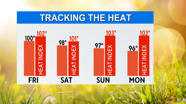
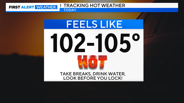
As we continue moving through your Friday, we'll see mostly sunny to partly cloudy skies. High temperatures will be near 100° this afternoon. Feels-like temperatures will be between 102° and 105°.
While there are no heat alerts in place today, let's still stay safe from the heat. Take breaks outdoors frequently, drink lots of water, and keep an eye on your kids and pets. Look before you lock the car so that our little ones are not left behind during the sweltering heat.
This weekend, we're going to get a break from the most extreme heat that we've had over the past several days.
In fact, the area of high pressure that has been positioned over our area will shift east a bit, allowing for a weak cold front to nudge in. That front will give us more clouds, a chance of storms and lower temperatures.
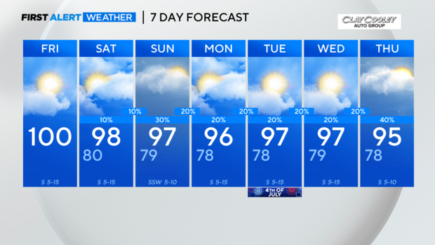
So, on Saturday, we'll see partly sunny skies. We can't rule out a shower or storm, especially well west of I-35 and I-35W. Most areas will be dry Saturday. High temperatures will be in the upper 90s. Feels-like temperatures will be near 101° by afternoon.
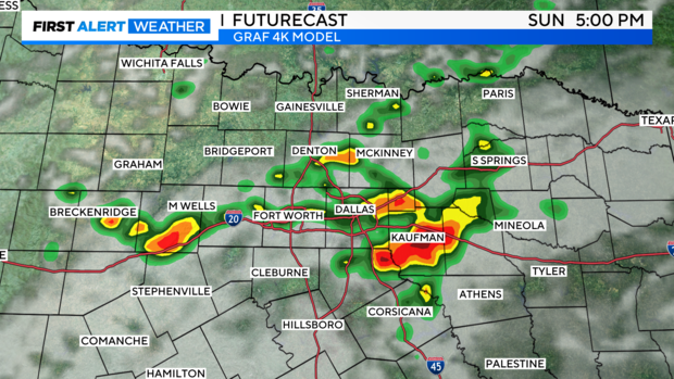
On Sunday, we'll see a slightly higher chance of storms. The chance of rain is around 20-30%. The threat for severe weather is low for now. Otherwise, we'll see mostly cloudy skies with highs in the mid 90s. Feels-like temperatures will be near 103° by afternoon.
For Monday, highs will be in the mid 90s. It will feel hotter. An isolated storm is possible.
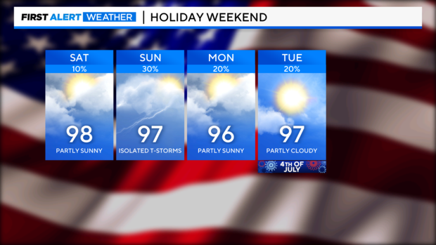
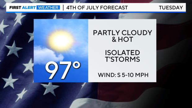
Then, for the Fourth of July on Tuesday, don't let the threat for a shower or two ruin your holiday plans. The chance of rain is 20%. Otherwise, we'll see partly cloudy skies and highs in the mid to upper 90s. Feels-like temps will be in the triple digits.