Flood warnings, advisories continue in North Texas

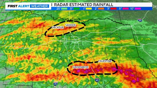
NORTH TEXAS — Flooded roads plagued parts of North Texas Sunday in the wake of rain falling most of the day.
The rain is moving off to the east Sunday night.
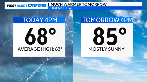
Temperatures stayed in the 60s all day! Monday afternoon will feel much different.
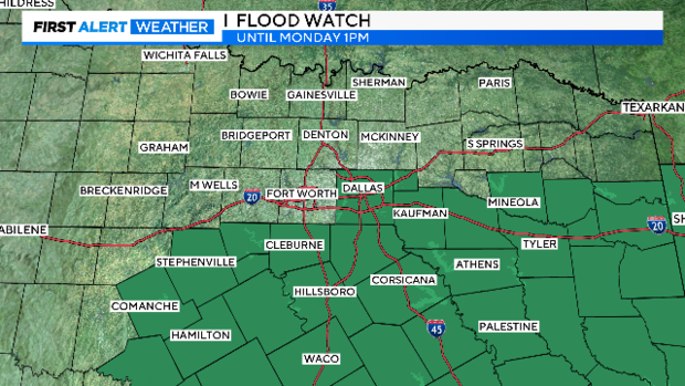
Monday will not be storm or rain-free. The Flash Flood Watch for the southern half of North Texas continues until 1 p.m. Monday.
There is also a risk of severe weather in the same general area. Large hail and damaging winds are the main threats. There is a small, but not zero, tornado chance.
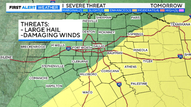
There will be some patchy fog Monday morning along with passing showers and a few non-severe storms.
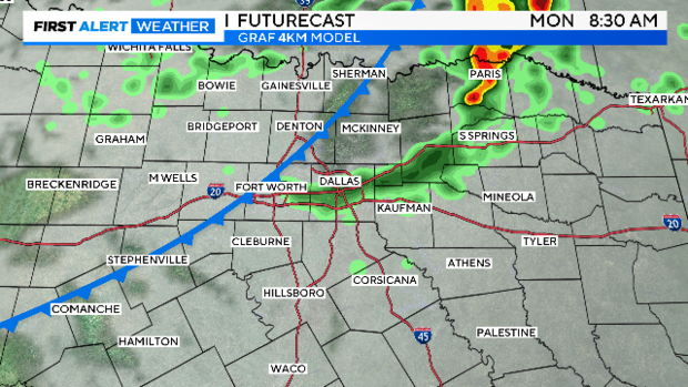
By afternoon, a front will push the risk of storms to our southeast as it stalls.
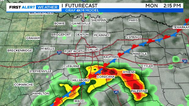
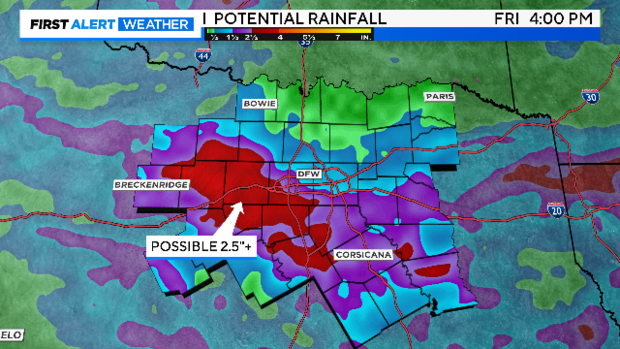
These storms leave by evening. We'll enjoy some dry weather for Tuesday and most of Wednesday until the next system arrives. Rain chances pick up Wednesday night and Thursday, and strong to severe storms are possible along with yet another round of heavy rain and a flood threat.
We are going to include small storm chances this coming weekend for now. Some warmer weather settles in next weekend. It should dry out some after that as we start a run of 90s for the first time this year.
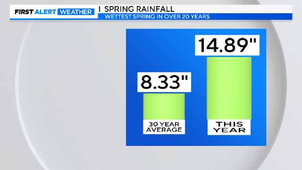
While the DFW Airport didn't get hit with any of the big rain Sunday, we are still well above normal rainfall this spring.
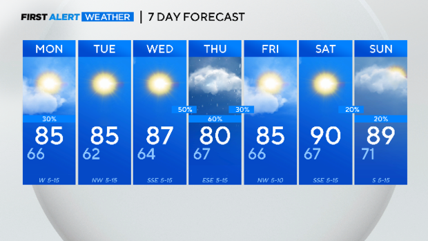
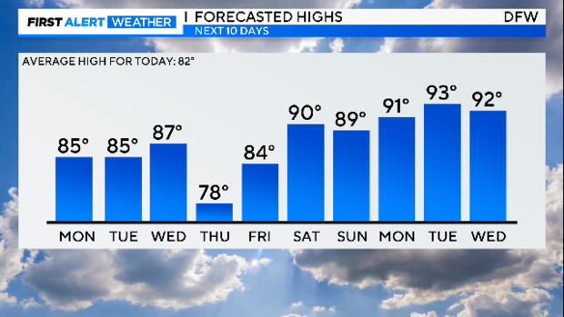
Here is your 7-day forecast.