First Alert Weather Day Overnight Into Thursday Morning
NORTH TEXAS (CBSDFW.COM) - It's warm and breezy but there's a low fire danger today, Feb. 16, with severe storms possible after midnight.
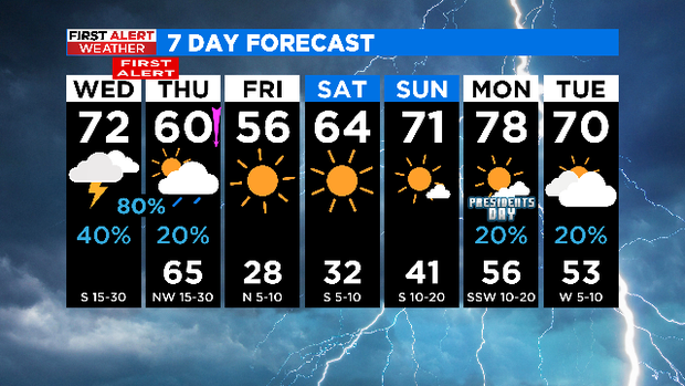
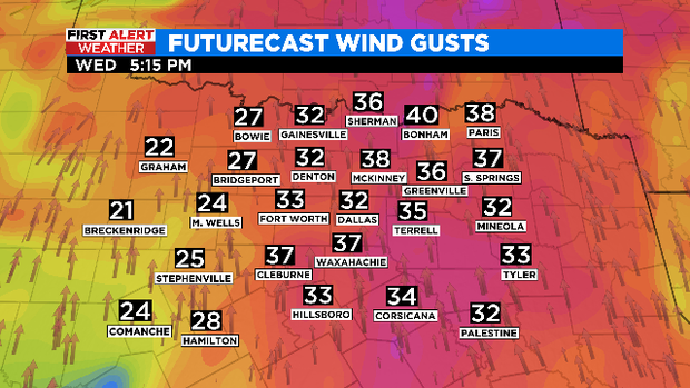
We have another warm and windy day ahead with highs in the lower 70s. Today will be overcast with scattered showers mainly east of I-35. Our strong southerly winds will gust to near 40 mph and continue to draw in Gulf moisture helping to lessen the fire danger.
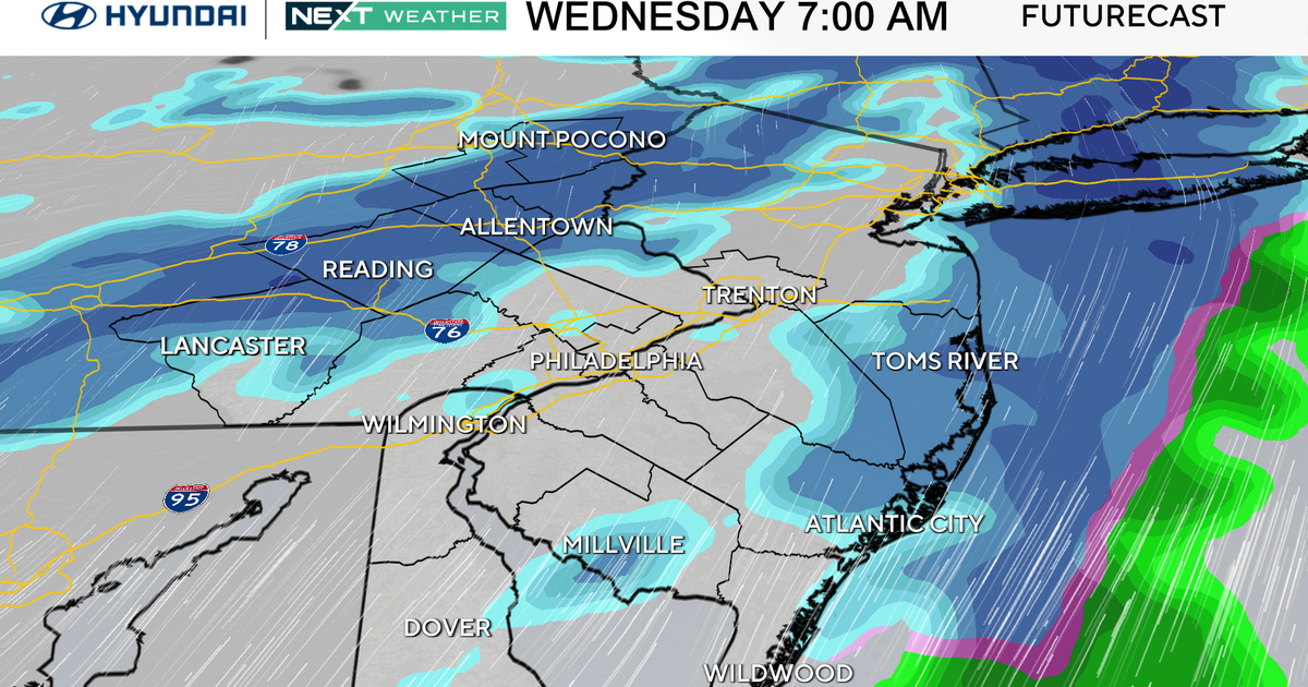
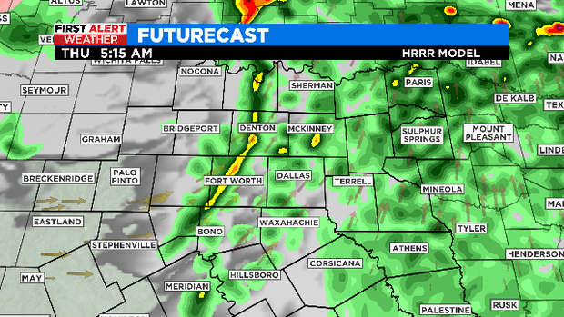
Latest models continue to develop a line of storms in our western counties around 1 a.m. along a dryline and move them east through 8 a.m.
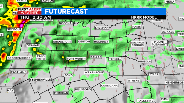
Timing in the metroplex looks to be around 3-5 a.m.
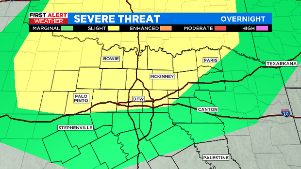
We are still under a slight risk for severe storms. Large hail when the storms initialize out west and damaging winds as the line moves through DFW are the main threats. But a quick spin up tornado in the line can't be ruled out.
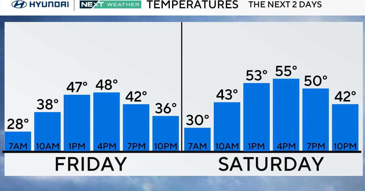
Once the line of rain/storms clears mid-morning Thursday a strong cold front slides in and shifts our winds out of the north. This will cause our temperatures to fall into the 40s by the afternoon. Skies clear, winds subside, and cold air is in place Friday morning allowing temperatures to drop into the upper 20s.

The sunshine is back for Friday with highs in the mid 50s. The weekend has some chilly mornings but the afternoons are warming back up and looking gorgeous.