Record high tides continue to impact Bay Area low-lying areas; flood advisories extended to Halloween
The Bay Area was seeing another day of record high tides driven by a combination of high astronomical tides, thermal expansion, and El Niño-related water level anomalies.
In San Francisco, high tide was expected to peak around 12:56 p.m. Wednesday at 7.7 feet above baseline, boosted by both a scheduled high tide running 1.9 feet higher than normal and an extra 1.2 feet of water from El Niño conditions, National Weather Service forecasters said.
The region's water levels prompted the NWS to once again extend coastal flood advisories as more minor-to-moderate coastal flooding is expected throughout the week. The advisory will remain in effect for shoreline locations of San Pablo Bay, San Francisco Bay, and Monterey Bay until 6 p.m. Saturday, and until 5 p.m. Saturday for the North Bay and Peninsula coast.
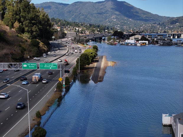
The region has experienced multiple broken records recently for exceptionally high tides driven by El Niño conditions and thermal expansion in October. In southern Marin County, flooding this week has closed roads, stranded cars and led to some drivers having to be pulled from their disabled vehicles.
The weather service and local authorities urge drivers to avoid driving on flooded streets, warning that even six inches of water can trap or disable a vehicle. Drivers are reminded that it is difficult to judge how deep water is just by looking at it, and floodwaters also hide the condition of the roadway. Floodwaters can rise rapidly and easily push a car off the road or downstream, putting occupants and first responders in life-threatening danger, authorities say.


