Flood watch, evacuation orders remain in effect as heavy rain hits Southern California
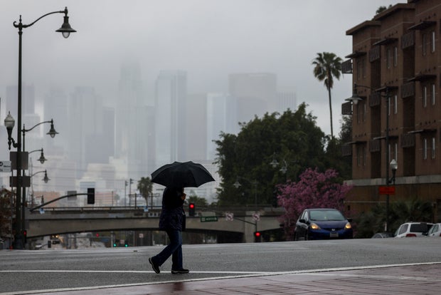
A flood watch remains in effect Thursday for parts of Southern California as the region experiences rainfall and flooding conditions.
The National Weather Service issued a flash flood warning for the Airport Fire burn scar area and parts of Orange County that expired at 7:30 a.m. as heavy downpour was moving through the area. KCAL News Meteorologist Amber Lee said the storm was moving from LA County to the east, which is what prompted the warning to be issued.
Lee said the NWS canceled the flash flood warning for the Eaton and Sunset burn scar areas shortly before 4:30 a.m. Thursday.
Overnight, a "strong storm" brought heavy rain, mountain snow and gusty winds, the NWS said. Weather officials have been monitoring rainfall totals, which have been between 1 to 1.50 inches across flatter portions of Santa Barbara and Ventura counties. The foothills and slopes have received between 1.50 and 3.0 inches of rain.
Scattered showers could remain in the late morning as the cold front continues to make its way out of the region.
The NWS said mountain areas will continue to experience snow and winter weather warnings and advisories will remain through the day. Areas above 6,000 feet could receive between 1 to 2 feet of snow.
Rainfall totals in Los Angeles County
The NWS has released preliminary data about how much rain has fallen across LA County overnight.
Rain is expected to continue throughout the morning hours. KCAL News Meteorologist Marina Jurica said rain will continue throughout the morning hours and should decrease by 10 a.m. in most areas.
| LA County | 1H | 3H | 6H | 12H | 24H | 48H | 5D |
Culver City | .11 | .65 | .90 | .90 | .93 | 1.00 | 1.01 |
Hollywood Rsvr | .10 | .52 | .97 | 1.00 | 1.04 | 1.10 | 1.10 |
Downtown LA | .12 | .69 | 1.00 | 1.00 | 1.15 | 1.19 | 1.19 |
Agoura | .10 | .38 | 1.07 | 1.07 | 1.18 | 1.23 | 1.23 |
Canoga Park | .11 | .47 | .94 | .98 | 1.02 | 1.25 | 1.25 |
Eaton Dam | .08 | .77 | 1.13 | 1.15 | 1.25 | 1.26 | 1.26 |
Claremont | .22 | .48 | .54 | .55 | .57 | .60 | .60 |
San Gabriel Dam | .16 | 1.03 | 1.22 | 1.22 | 1.34 | 1.34 | 1.34 |
Mount Wilson | .08 | .52 | .75 | .81 | .94 | 1.12 | 1.12 |
Evacuation orders and warnings
Several mandatory evacuation orders and warnings were issued in the Palisades, Eaton and Sunset fire burn scar areas.
Orders and warnings are also in effect in parts of Sierra Madre, given the dangerous mudslides last month. The orders will be in effect until 6 p.m. Thursday.
- Mandatory evacuation zones: SMD-E001, SMD-E002A, SMD-E002B, SMD-E002C, SMD-E003, SMD-E004, SMD-E005, SMD-E006A, SMD-E006B, SMD-E007, SMD-E008, SMD-E009, SMD-E010A, SMD-E010B, SMD-E011A, SMD-E011C, SMD-E012A, SMD-E012B, SMD-E012C, SMD-E012D, SMD-E013B, SMD-E014B
- Evacuation warning zones: SMD-E011D, SMD-E013A, SMD-E014A, SMD-E015, SMD-E016
Local officials with the help of the LA County Department of Public Works analyzed vulnerable areas that could see potential damage caused by the storm. The orders and warnings were issued before the heavy storm made its way into the region.
"These evacuations are very strategic and very precise," said Director Mark Pestrella, at a news conference Wednesday. "They were part of a recommendation by Public Works to analyze the most vulnerable locations."
The LA Fire Department said emergency responders visited homes facing high risks of mudslides and debris flows before the storm started to warn residents of the potential dangers. A flyer was left if no one is home when crews made their visit.
The orders and warnings issued in recent burn scar areas will be in effect until 6 p.m. Thursday, the LAFD said.
- Palisades Fire: Getty Villa area, Rivas Canyon/Will Rogers State Park area, Highlands near the burn areas, Bienveneda area near Temescal Canyon Park, Mandeville Canyon above Tanners Road, Old Ranch Road and Rustic Creek
- Sunset Fire: East and South of Runyon Canyon
- Hurst Fire: Olive Lane in the Oakridge Mobile Home Park
Use this link to access a map of evacuation orders and warnings.


