Windy, wet weather zeroing in on Bay Area; incoming storm triggers flood watch, high wind watch
Another round of wet and windy weather was set to run through the Bay Area with the storm triggering multiple warnings and advisories.
Following an initial sprinkling Tuesday night into Wednesday morning mostly south of the Golden Gate, the National Weather Service said in its daily forecast discussion that a more vigorous system Wednesday night through Thursday would bring higher chances of flooding and damaging winds.
KPIX First Alert Weather: Current conditions, alerts, maps for your area
By Wednesday evening, the Weather Service said another atmospheric river pattern would develop, with heavy rainfall and potentially damaging winds.
A flood watch was in effect for Marin, Sonoma, San Francisco, San Mateo, Santa Cruz and Monterey counties from Wednesday evening through Saturday evening. The flood watch also includes most of the Central Coast and parts of the Central Valley until Friday evening. Lake and Mendocino counties were also included in the flood watch until Thursday afternoon.
Meanwhile, a flood warning was issued for the Yolo Bypass area bordering Solano and Yolo counties until early Friday morning.
In addition, the Weather Service issued a high-wind watch from Wednesday evening through Friday morning for the interior mountains and valleys of the North Bay, the East Bay and San Francisco Bay shoreline, the Peninsula coast, the Santa Clara Valley and eastern hills, the Santa Cruz Mountains, Monterey Bay, Big Sur, and the Central Coast.
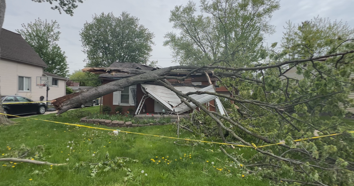
Damaging winds with gusts of up to 40-45 mph could down trees, snap power lines, and blow loose debris, and the Weather Service said widespread power outages are possible. There is also a slight risk for thunderstorms Thursday afternoon before the storm begins to clear up with showers lingering into Friday morning.
On the coast, the Weather Service also issued a high surf warning for dangerously large breaking waves of 20 to 30 feet and up to 45 feet for the highest waves on west-facing beaches. Beaches not facing west will still see 15- to 20-foot waves and up to 30-foot peak waves.
The warning was in effect from 3 p.m. Thursday to 3 a.m. Saturday along the entire coastline from Point Reyes National Seashore to the southern Monterey Bay and Big Sur coast. The Weather Service warned that breaking waves can sweep people off jetties and docks, and life-threatening swimming conditions and significant beach erosion are expected.
For the duration of the storm, while the North Bay will see rainfall totals in the 2-4 inch range, the greater Bay Area will see a range of 1.5 to 3 inches of rain, 4 to 6 inches and possibly up to 8 inches in the Santa Cruz Mtns, 2 to 3 inches across the Central Coast counties, and 3-6 inches along the Big Sur coast.