NASA
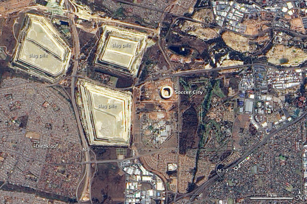
Soccer City sits in Johannesburg's Soweto Township. The site of the June 11 opening game for the 2010 World Cup, Soccer City is nevertheless dwarfed by nearby slag piles left over from decades-long mining operations.
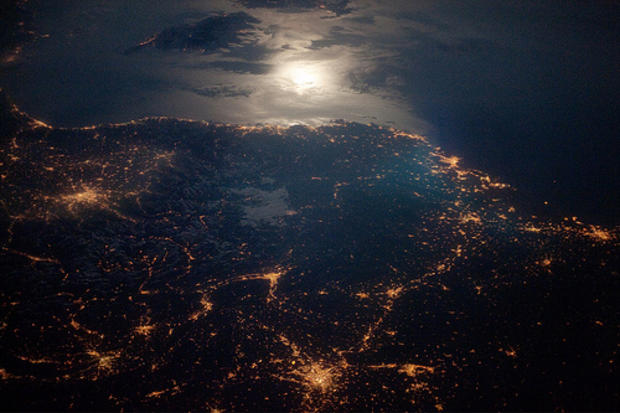
City Lights at Night along the France-Italy Border
NASA
The brightly lit metropolitan areas of Torino (Italy), Lyon, and Marseille (both in France) stand out amidst numerous smaller urban areas. The southwestern end of the Alps Mountains separates the two countries. The island of Corsica is visible in the Ligurian Sea to the south (image top).
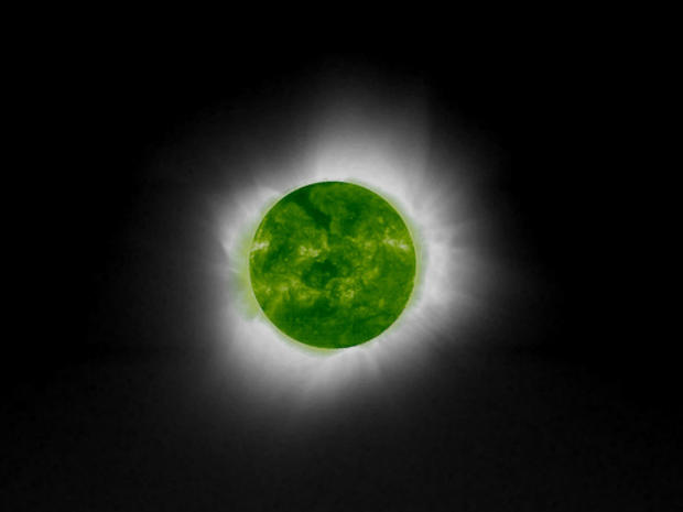
Australia
NASA
On December 3, 2002, people in Australia received a rare 32-second celestial show as the Moon completely obscured the Sun, creating a ring of light. his total eclipse was the first to cover Australian shores since 1976. The next is not predicted to occur for several more decades.
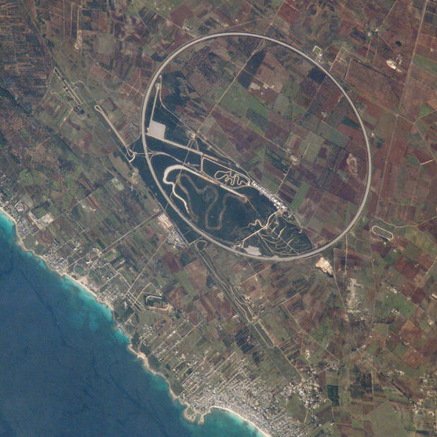
Nardo Ring, Italy
NASA
The Ring is a 12.5 kilometer long race car test track. Although it is a perfect circle, it appears oval in this photograph. This distortion is because the astronaut's viewing angle was 35 degrees, looking back along the orbit track to the southwest from the International Space Station's window.
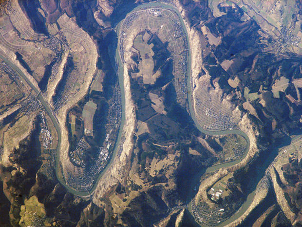
Moselle River Gorge, Germany
NASA
This detailed image (width covers a distance of 14.5 kilometers, or about 9 miles) shows the winding Moselle River flowing north (left to right). The river has cut a gorge more than 300 meters (984 feet) deep into a relatively flat plateau. The plateau is covered mainly in dark green forests, with some large agricultural fields.
Korea
NASA
Typhoon Nabi is featured in this image photographed by an Expedition 11 crewmember on the International Space Station, as it swirls in the Pacific Ocean, heading toward southern Korea and Japan. At the time this image was taken Typhoon Nabi was generating sustained winds of 100 knots, gusting to 120 knots.
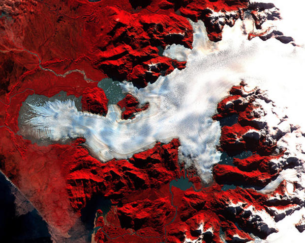
Chile
NASA
Image of a Patagonian glacier. Vegetation appears red in the image, which is a false-color composite of near-infrared, red, and green light displayed as red, green, and blue, respectively.
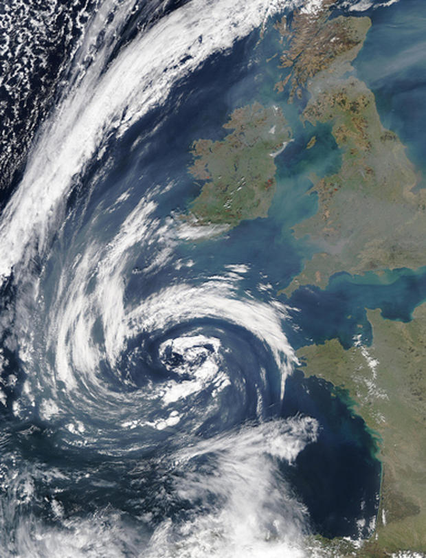
Haze over the United Kingdom
NASA
A large low-pressure system off the southweast coast of the United Kingdom was entraining a lot of haze (gray pixels) from over northwestern Europe on March 23, 2003.
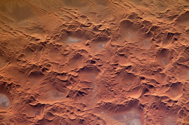
Algeria
NASA
The Issaouane Erg (sand sea) is located in eastern Algeria between the Tinrhert Plateau to the north and the Fadnoun Plateau to the south. Ergs are vast areas of moving sand with little to no vegetation cover. Considered to be part of the Sahara Desert, the Issaouane Erg covers an area of approximately 38,000 kilometers.
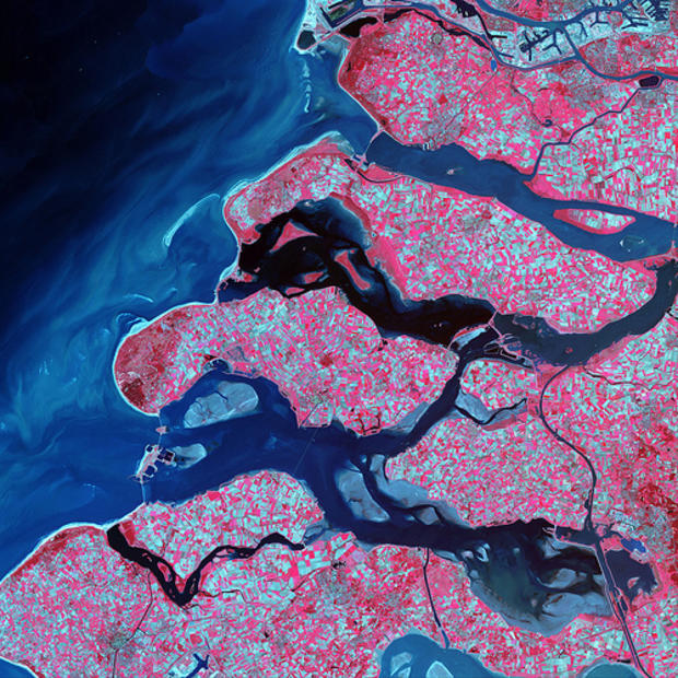
Netherlands
NASA
Along the southern coast of the Netherlands, sediment-laden rivers have created a massive delta of islands and waterways in the gaps between the coastal dunes. After unusually severe spring tides devastated this region in 1953, the Dutch built an elaborate system of dykes, canals, dams, bridges, and locks to hold back the North Sea.
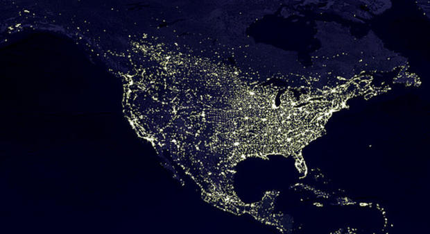
United States
NASA
Slovakia
NASA
This particular image, from the Terra MODIS instrument, shows snow cover and clouds on the land and water. The bright turquoise and black colors correspond to ice- and snow-free land and water (respectively), while white corresponds to cloud cover, and red corresponds to snow.
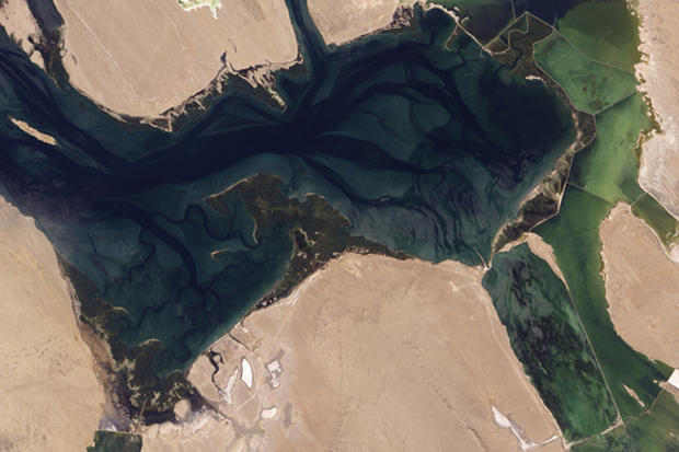
Mexico
NASA
About halfway between the U.S-Mexico border and the southern tip of Baja California, facing the Pacific Ocean, lies Laguna Ojo de Liebre.
Along the eastern edge of the image, signs of industrialization prevail. An evaporation pond associated with the salt works appears in the southeast, and human-built barriers trace thin, curving lines of white. The relatively shallow waters enclosed by these barriers appear yellow-green.
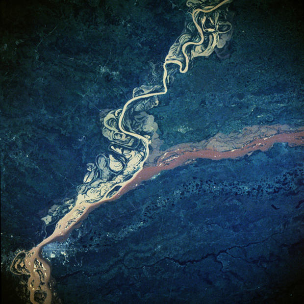
Paraguay
NASA
The confluence of the Paran
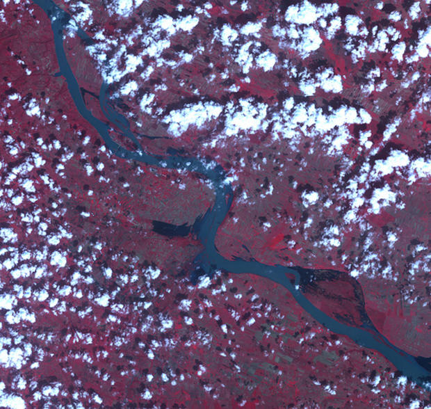
Serbia
NASA
Floods on the Danube River. Melting snow and spring rain have driven rivers across Central Europe over their banks, causing widespread flooding on April 24, 2006.
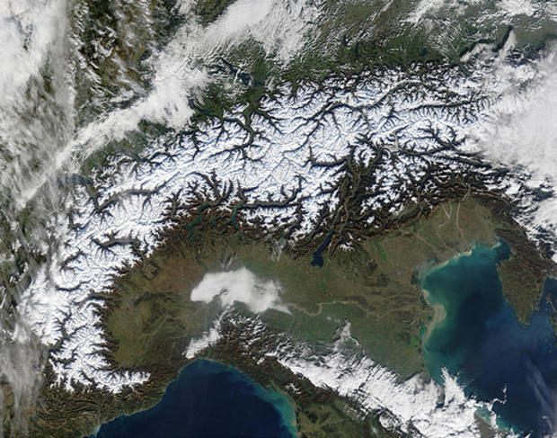
Switzerland
NASA
The Alps march across these true-color MODIS images of Autumnal southern Europe. On either side of and above the Alps are the countries of (from left to right) France, Switzerland, Liechtenstein, Austria, and Slovenia, while below the Alps is Italy. The Mediterranean and Ligurian Seas sit to the west of Italy, while to the right is the Adriatic Sea. As the season progresses, snow begins to whiten the Alps.
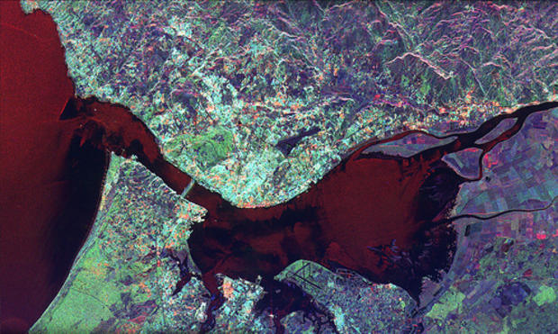
Portugal
NASA
Radar image of Lisbon, Portugal.
The city center appears as the bright area in the center of the image. The green area west of the city center is a large city park called the Parque Florestal de Monsanto. The Lisbon Airport is visible east of the city. The Rio Tejo forms a large bay just east of the city.
Spanning the river is the Ponte 25 de Abril, a large suspension bridge similar in architecture to San Francisco's Golden Gate Bridge.
Cameroon
NASA
Bamenjing Reservoir, Cameroon, Africa.
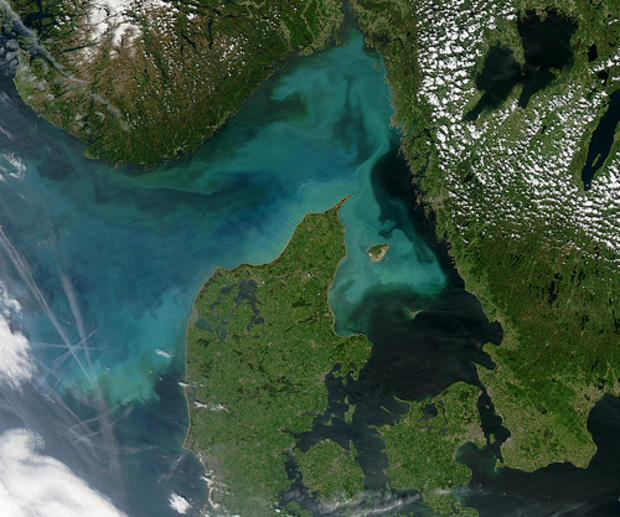
Denmark
NASA
A large phytoplankton bloom fills Skagarrak, a gulf of the North Sea north of Denmark's Jutland peninsula, and spills into the North Sea on the west and Kattegat on the east
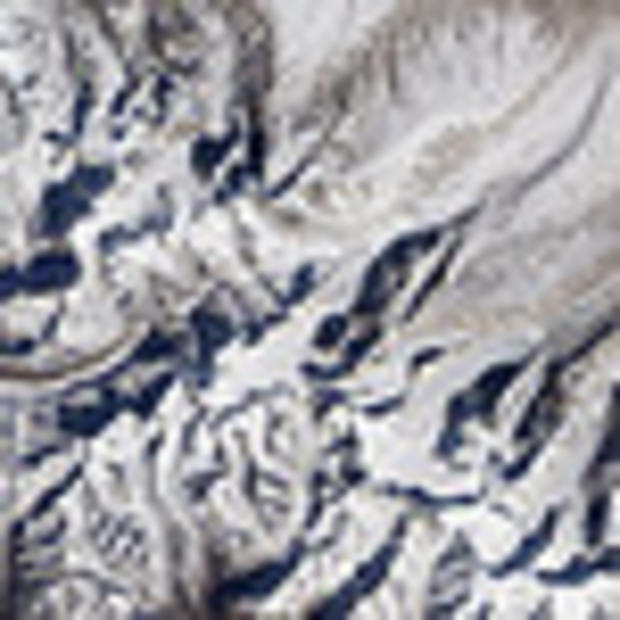
Himalayan Glacier, Southern China
NASA
The Himalayan Mountain Range holds thousands of glaciers. In southern China, just north of the border with Nepal, one unnamed Himalayan glacier flows from southwest to northeast, creeping down a valley to terminate in a glacial lake
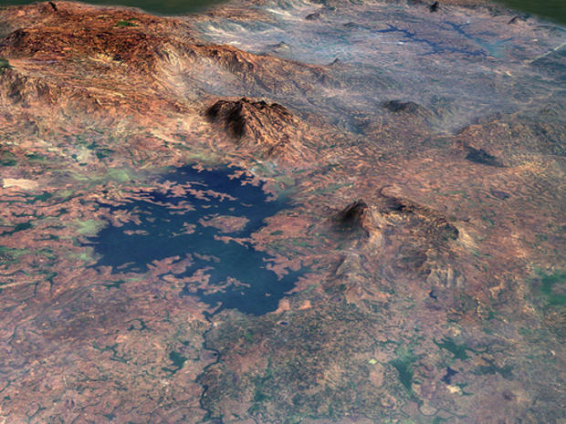
Patagonia, Argentina
NASA
A topographic image of Patagonia.
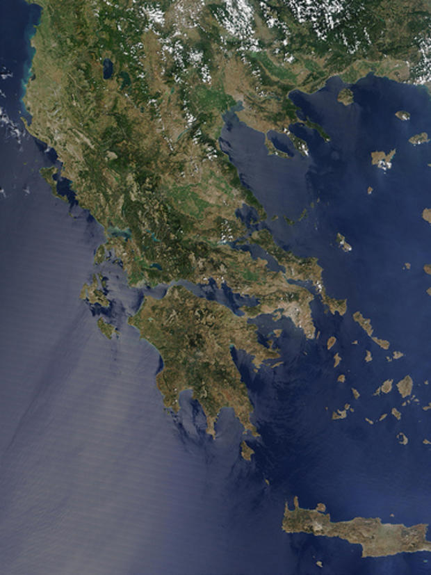
Greece
NASA
Athens, the modern-day capital of Greece and one of the strongest city-states in ancient times, sits across the bay from the large island ofPeloponnisos (lower center). Athens appears gray and is dotted by a few low white clouds. Peloponnisos was home to Sparta, a city-state that wasoften at odds with Athens. Sparta was located just north of the center of the three south-facing fingers of Peloponnisos. Also visible in this image are the modern-day nations of Albania (top left), Macedonia (top center), and Bulgaria (top right).
Japan
NASA
A very well-defined spiral eddy is visible through the haze off the east coast of Japan in this image.
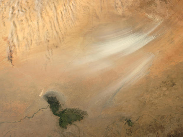
Nigeria
NASA
Once serving as part of the floor for a much larger Lake Chad, the area now known as the Bodele Depression, located at the southern edge of the Sahara Desert in north central Africa, is slowly being transformed into a desert landscape.
New Zealand
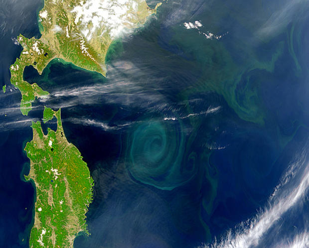
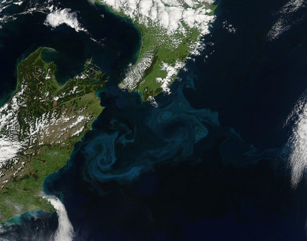
NASA
Off the east coast of New Zealand, cold rivers of water that have branched off from the Antarctic Circumpolar Current flow north past the South Island and converge with warmer waters flowing south past the North Island.
The surface waters of this meeting place are New Zealand's most biologically productive.
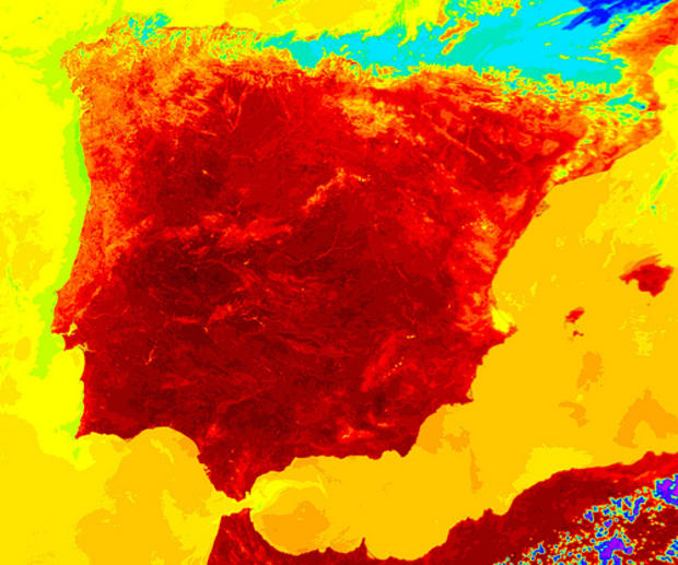
Spain
NASA
On July 1, 2004, Spain (roughly the right-most three-quarters of the peninsula) and Portugal (left-hand quarter) were in the midst of a blistering heat wave. Scientists have color-coded in shades of pink (coldest temperatures) to blackish-red (highest temperatures).
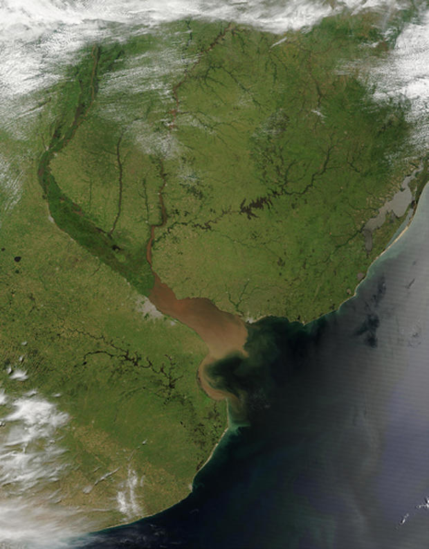
Uruguay
NASA
The onset of Southern Hemisphere summer across Argentina (left), Uruguay (center), and southern Brazil (upper right.)
Honduras
NASA
This SeaWiFS image of Central America shows what looks like smoke coming from Mexico, Guatemala, Belize, and Honduras. The smoke can be seen drifting over the Campeche Bank and over Belize's barrier reef.
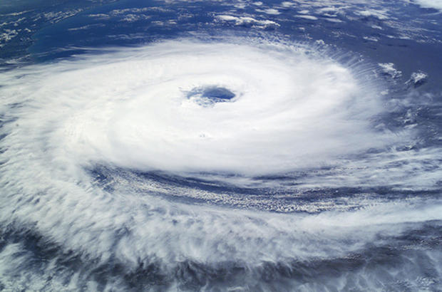
Brazil
NASA
"Hurricane" Catarina hits Brazil on March 26, before eventually making landfall late on Saturday, March 27, 2004. The crew of the International Space Station was notified of the cyclone and acquired excellent photographs of the storm just as it made landfall on the southern Brazilian state of Catarina