Rain returns to Philadelphia area Wednesday afternoon, followed by colder temps. Here's the forecast.
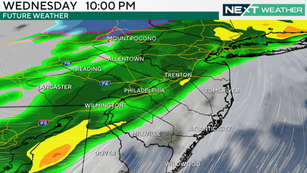
Our next rainmaker will arrive today. Light rain showers will break out around the Philadelphia area by around 3 p.m., with some steadier rain likely starting after 5 p.m. The heaviest rain near the city will likely occur around 7-8 p.m., but the rain will not completely clear until after midnight.
After that, some cooler winds will arrive Thursday, with a drop in the mercury, but that just brings us back to seasonable with highs in the mid-40s.
A new system off the coast will make Friday a close call, but it looks like the bulk of the precipitation will miss us offshore. Just a brush of moisture will give the area the chance for evening or nighttime rain or snow showers.
Then we open the floodgates to Arctic cold just in time for the official start of winter Saturday. Highs on Saturday will only be in the mid-30s, and Sunday is even colder — highs in the 20s, making it the coldest of the season so far. While we'll keep it cold Monday, it does look like a pretty rapid warming trend is on the docket for Christmas and beyond.
Stay with the NEXT Weather team as we continue to track the rain and snow showers and up and down temperatures!
7-day forecast
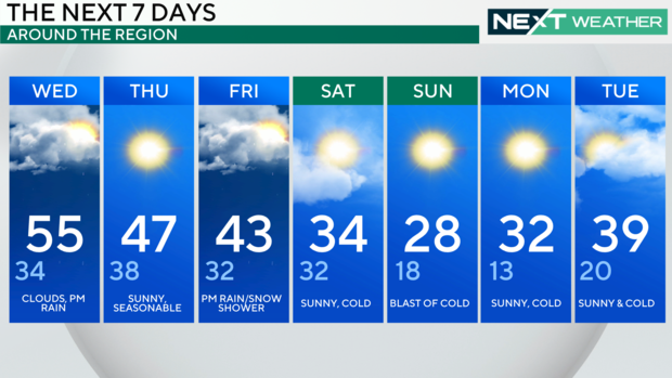
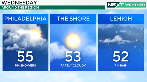
Wednesday: High of 55, low of 34, clouds, p.m. rain
Thursday: High of 47, low of 38, sunny and seasonable
Friday: High of 43, low of 32, p.m. rain/snow shower
Saturday: High of 34, low of 32, sunny and cold
Sunday: High of 28, low of 18, blast of cold
Monday: High of 32, low of 13, sunny and cold
Tuesday: High of 39, low of 20, sunny and cold


