Sunny, breezy day across the Philadelphia region as coastal flooding concerns diminish. Here's the forecast.
Another beautiful fall day ahead! We'll see plenty of sunshine with highs near 70 degrees around Philadelphia. It will be breezy, with northwest gusts around 20–25 mph, but most of the region stays dry and pleasant.
After a chilly start in the 40s, sunshine will help temperatures climb into the upper 60s this afternoon, right around average for this time of year.
Dewpoints remain low, generally in the 30s and 40s, so there's no humidity to worry about.
Our offshore nor'easter officially became Subtropical Storm Josephine yesterday afternoon! The storm is finally beginning to pull away, although lingering minor coastal flooding remains a concern in parts of Ocean County, NJ, and Sussex County, DE this morning. Rough surf and some additional beach erosion will continue before conditions gradually improve.
Tonight stays clear and cool inland, with temperatures falling into the lower to mid 40s around Philadelphia and the 30s in some colder suburbs.
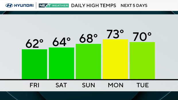
Looking ahead, we've got a beautiful stretch of fall weather! Highs drop into the lower 60s Friday and Saturday, with plenty of sunshine through the weekend. Frost is possible in some suburbs both Friday and Saturday nights.
NEXT big weather changes
Our biggest weather story is actually moving away from us! The coastal storm we've been tracking for several days has officially become Subtropical Storm Josephine, with sustained winds of 65 mph early this morning.
Josephine is accelerating northeastward, well offshore, and is expected to strengthen further as it transitions into a powerful extratropical storm. The good news is that its strongest winds and heaviest rain will remain over the Atlantic, with impacts along our coastline gradually diminishing.
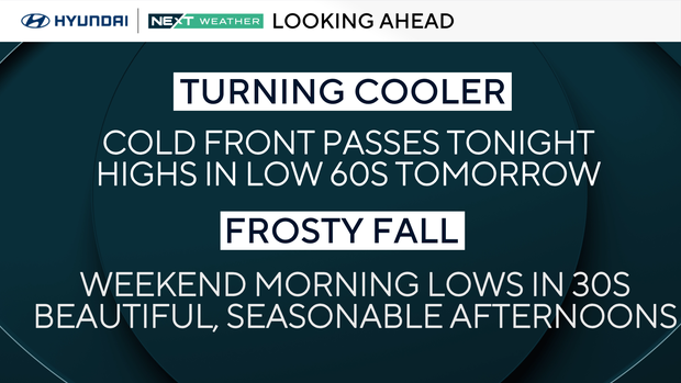
For Philadelphia and our inland suburbs, our next change comes in the form of another push of cooler air. An upper-level trough moving through the Northeast Friday will reinforce the chilly, dry air mass already in place, while strong high pressure builds in from Canada.
Friday will be mostly sunny, with highs in the lower 60s, but temperatures will drop quickly after sunset as winds diminish.
Lows Friday night could fall into the 30s across many suburbs, with patchy frost possible north and west of Philadelphia. Some of our coldest locations could even approach the freezing mark.
The weekend looks fantastic for outdoor plans, with plenty of sunshine and no significant rain in the forecast. Saturday starts chilly, with highs reaching the lower 60s, while Sunday should be a little milder with temperatures climbing into the mid 60s.
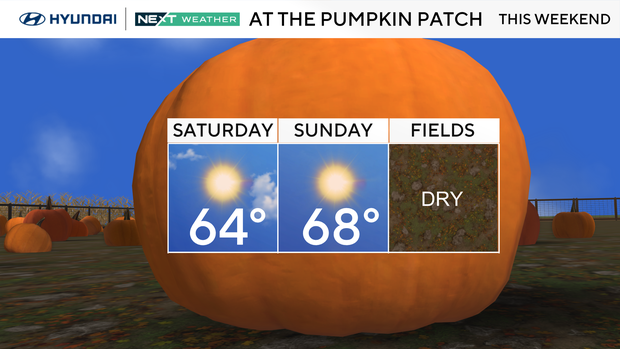
Another cold night is possible Saturday night, with patchy frost again in some outlying areas. Temperatures continue moderating early next week, reaching the upper 60s to around 70 degrees Monday before clouds potentially increase toward midweek.
The bottom line: Josephine is moving away, coastal conditions are improving, and we're heading into a beautiful stretch of crisp, dry fall weather!
Overall, a beautiful but crisp fall weekend ahead.
Here's your 7-day forecast:
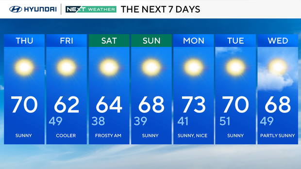
Thursday: Sunny. High 70
Friday: Cooler. High 62, Low 49
Saturday: Frosty start. High 64, Low 38
Sunday: Sunny. High 68, Low 39
Monday: Sunny, nice High 73, Low 41
Tuesday: Sunny. High 70, Low 51
Wednesday: Partly cloudy. High 68, Low 49
Get the latest weather info on the CBS News Philadelphia app.


