See Texas fires map and satellite images of wildfires burning in Panhandle and Oklahoma
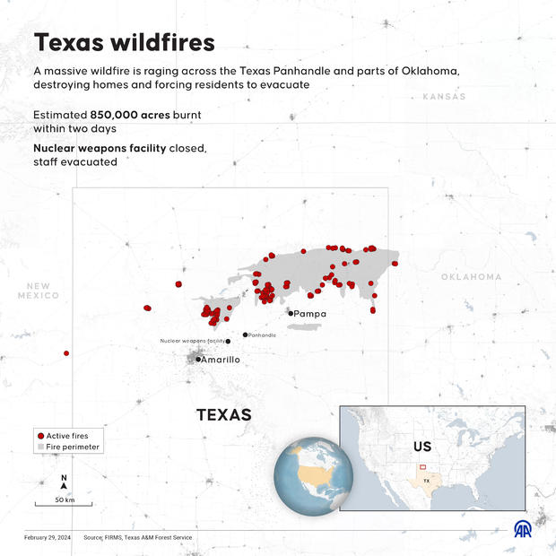
The Texas fires have destroyed hundreds of homes and businesses in the Lone Star State, leaving a path of destruction larger than the size of Rhode Island and forcing a nuclear plant to take precautions. A map shows the fires, which have killed at least two people, located throughout the state's rural Panhandle area, with some blazes crossing into western Oklahoma.
Where are the Texas fires burning?
The fires are burning northeast of Amarillo, a city of over 200,000 people.
The largest of the fires, the Smokehouse Creek Fire, is the biggest blaze in Texas history. On Thursday, the Texas A&M Forest Service said the inferno was an estimated 1.059 million acres. The agency said the size of the fire was lower than its last estimate of 1.076 million acres because of additional data collection and more accurate mapping. The fire was 74% contained, according to the forest service.
In Hutchinson County, which includes the hard-hit towns of Fritch and Stinnett, about 200 families have been displaced by the fires, according to Julie Winters, executive director of the local United Way.
"We have some veterans that have been displaced with this, we have elderly people that have been displaced, we have young families," Winters told CBS News on Monday.
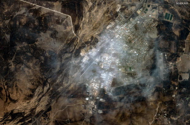
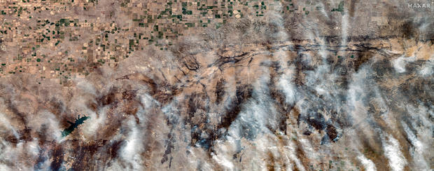
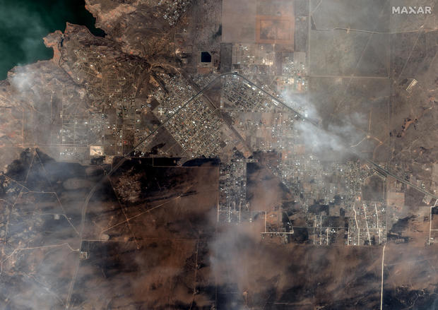
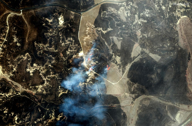
A 20-second video of satellite images posted by the Cooperative Institute for Research in the Atmosphere showed the fires growing in Texas and spreading to Oklahoma. Satellite images also show how the fires have affected Fritch, Texas, with one image showing how the town looked from above last summer.
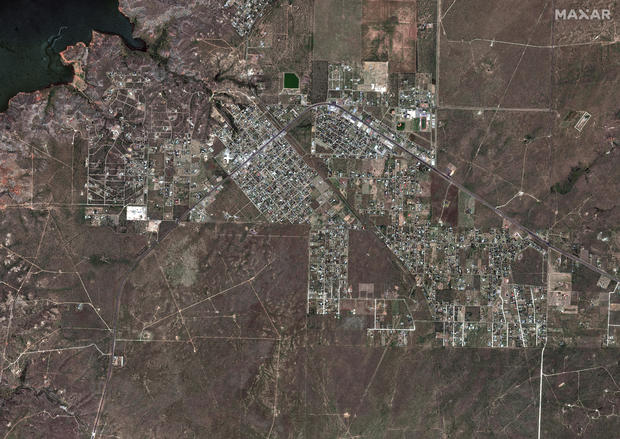
The town's mayor said dozens of homes have been destroyed in the blazes, according to the Associated Press. One family in Fritch told CBS News that their home was burned to "nothing but ash." Texas Gov. Greg Abbott said Friday about 400 to 500 structures in the Panhandle had been destroyed so far.
Rian Hightower told CBS News Texas she and her family barely made it out of their house in Fritch before it was in flames.
"We no longer got off of our street that the entire street was engulfed, so in a matter of seconds," she said.
"It looked like Armageddon, it looked like the end of the world," she said.
Winters told CBS News she saw some of the devastation Sunday night.
"One neighborhood, there's probably 70% of the homes have been completely burned down, there's nothing left," she said. "Another neighborhood, probably about 80%."
The fires have upended the lives of people living in several towns in the Panhandle. Hemphill County Emergency Management Coordinator Bill Kendall likened the scorched area to a moonscape. "It's just all gone," he said, according to the AP.
How has the area's nuclear plant responded to the Texas fires?
The Pantex nuclear plant, located about 30 miles east of Amarillo, evacuated nonessential personnel and constructed a fire barrier last Tuesday in response to a fire near the facility.
The Pantex plant is one of six production facilities for the National Nuclear Security Administration, according to the plant. The plant boasts being "the nation's primary assembly, disassembly, retrofit, and life-extension center for nuclear weapons" since 1975.
Operations returned to normal a day later, the plant said on social media.
"There is no imminent wildfire threat to the plant at this time," the plant said.
What caused the Texas fires?
Investigators with the forest service determined that power lines ignited the Smokehouse Creek Fire and a smaller blaze, the Windy Deuce Fire, the agency said in a statement to CBS News. As of Thursday, the Windy Deuce Fire was 89% contained, the agency said.
Also on Thursday, Minneapolis-based power company Xcel Energy said in a statement that its facilities may have been involved in starting the state's largest fire. "Based on currently available information, Xcel Energy acknowledges that its facilities appear to have been involved in an ignition of the Smokehouse Creek fire," the company said. It also said the company doesn't believe its facilities caused the Windy Deuce Fire.
A lawsuit filed late last week blamed the Smokehouse Creek Fire on a utility pole that snapped at its base, bringing down electrified lines that ignited the blaze. The suit is against Xcel, its subsidiary Southwestern Public Service Company and a contractor that inspects utility poles.
"Xcel Energy disputes claims that it acted negligently in maintaining and operating its infrastructure," the company said.
Dry grass, strong winds and warm temperatures have fueled the Panhandle fires and helped them spread.
In Canadian, Texas, a woman told CBS News that flames spread to her family's home when a rolling, burning tumbleweed came onto the property, burning down the house.