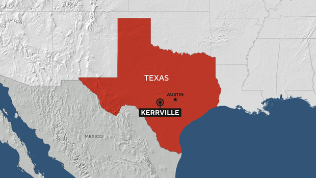
Maps show where devastating flash flooding hit Texas, including Camp Mystic
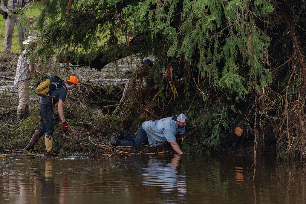
Devastating flash floods in Central Texas on Friday, July 4, have killed more than 130 people, including over two dozen at Camp Mystic, a Christian summer camp for girls along the Guadalupe River. More than 160 people remain unaccounted for, officials said, as emergency workers and volunteers continue to search the region.
Rivers rose rapidly in the early hours of July 4 as the region, known as Texas Hill Country, was saturated with rain.
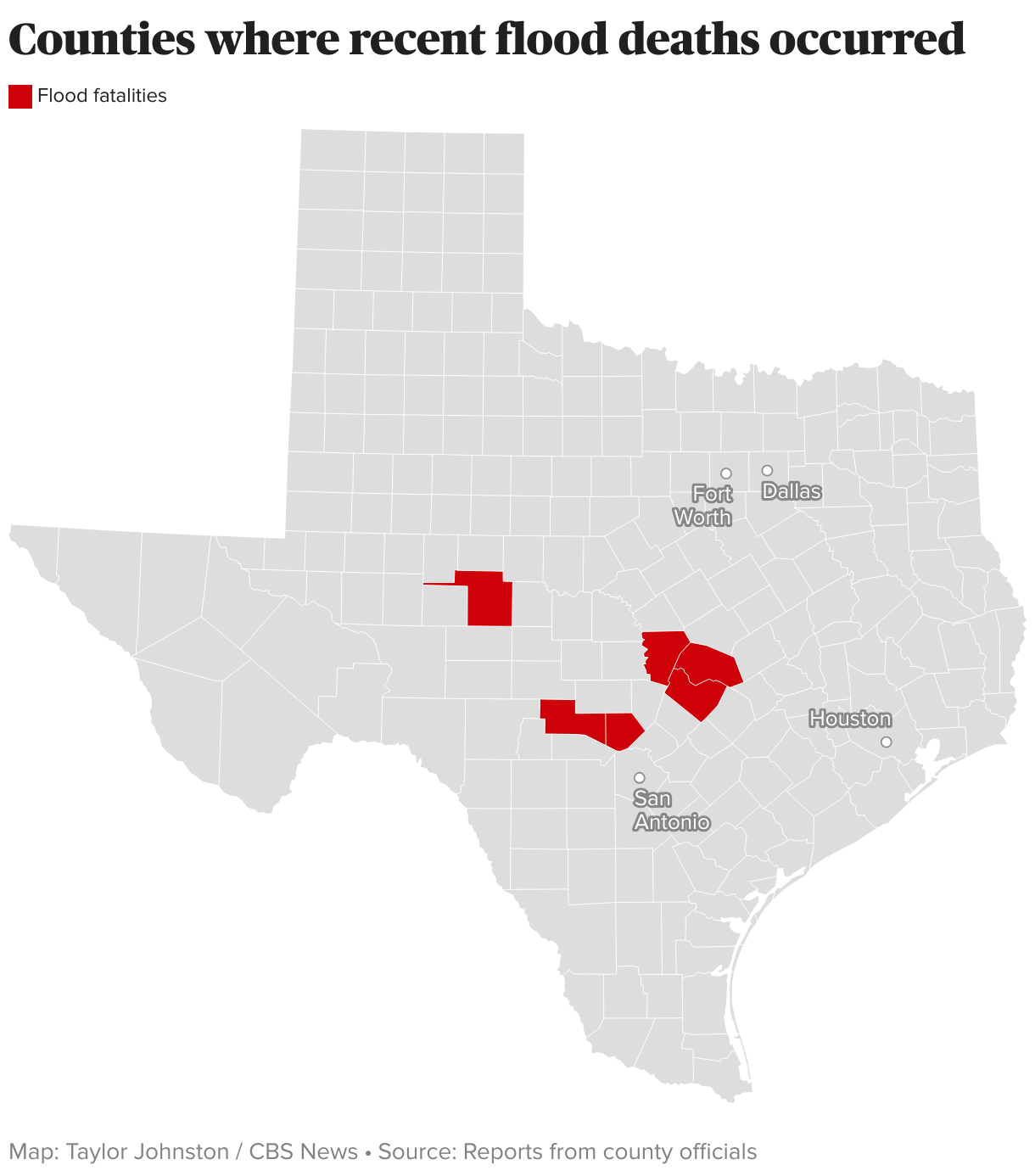
Where were the Texas floods?
The area hardest hit by the floods was Kerr County where the Guadalupe River rose to critical levels in multiple locations, according to National Weather Service data. Kerrville, the largest city in Kerr County, is roughly 100 miles west of Austin and 65 miles northwest of San Antonio.
Kerr County has reported by far the highest number of fatalities from the floods, with at least 95. The other counties to report fatalities are Travis County, where Austin is located; Kendall County; Burnet County; Williamson County; and Tom Green County.
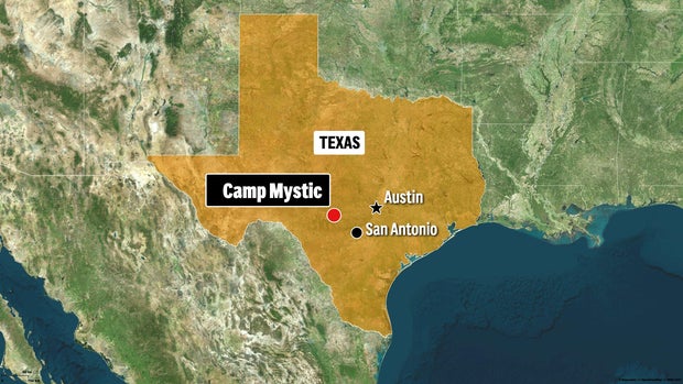
Camp Mystic located in Kerr County
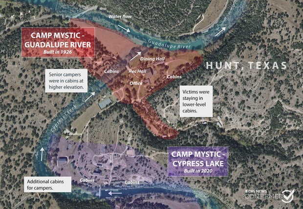
Camp Mystic, where at least 27 campers and counselors died in the floods, is in Hunt, Texas, part of Kerr County. Around 550 children were at the camp when the flooding started, according to a June 2 report from state health inspectors.
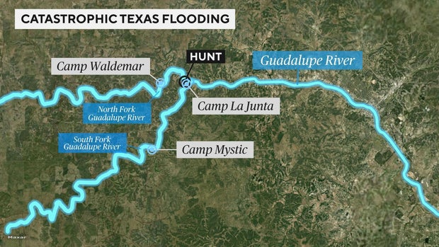
The camp is located on the banks of the Guadalupe River.
Other camps are also located along the river, including Camp La Junta, where two young brothers, Braeden and Brock Davis, were among the campers who escaped the floods.
Camp La Junta and another nearby, Camp Waldemar, said in Instagram posts that all campers and staff were safe.
What led to the flash flooding in Central Texas?
The worst of the damage took place in an area known as "Flash Flood Alley" due to its long history of flooding. Its terrain makes it especially vulnerable, with steep slopes, rocky ground and narrow riverbeds that react quickly in heavy rainfall.
The CBS News Texas I-Team reviewed National Weather Service and historical crest records and found that the Guadalupe River has experienced major flooding more than a dozen times in the last century. In 1987, floodwaters rose to 31 feet in nearby Comfort, killing 10 people, including children, after camp buses were caught in the rising current.
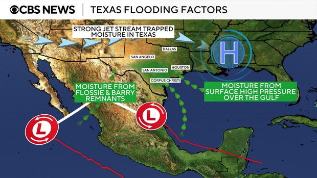
This time around, meteorologists say storms in the area converged with moisture from the remnants of former Tropical Storm Barry, which had been moving northward from Mexico. That produced exceptionally high rainfall totals in the overnight hours of July 4.
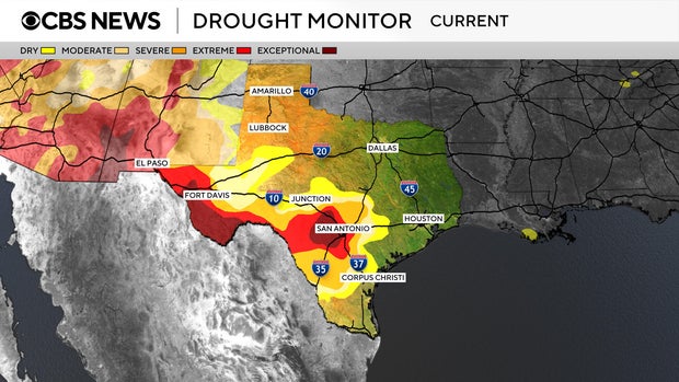
Drought conditions in the region only made flooding worse, because dry, parched soil is unable to absorb so much sudden rainfall. Central Texas was under "extreme" and "exceptional" drought conditions, seen in the map below.
Scientists have found that climate change intensifies both droughts and flooding because a warmer climate can extend intense dry spells as well as increase extreme precipitation.