Maps, data show how near-term climate change could affect major port cities on America's East Coast


What would happen if East Coast shipping ports were underwater and out of operation? Supply chains across the nation rely on these ports transporting trillions of dollars' worth of goods each year.
With experts predicting an average sea level rise of 2 feet by 2100, flooding is a reality that most seaports and beach communities will have to contend with. Now, a new climate study shows that some parts of the coast are likely to change even sooner.
The study, by the United States Geological Survey, used data derived from geographic and satellite observations to show how the northeastern U.S. coast might change within the next decade or so.
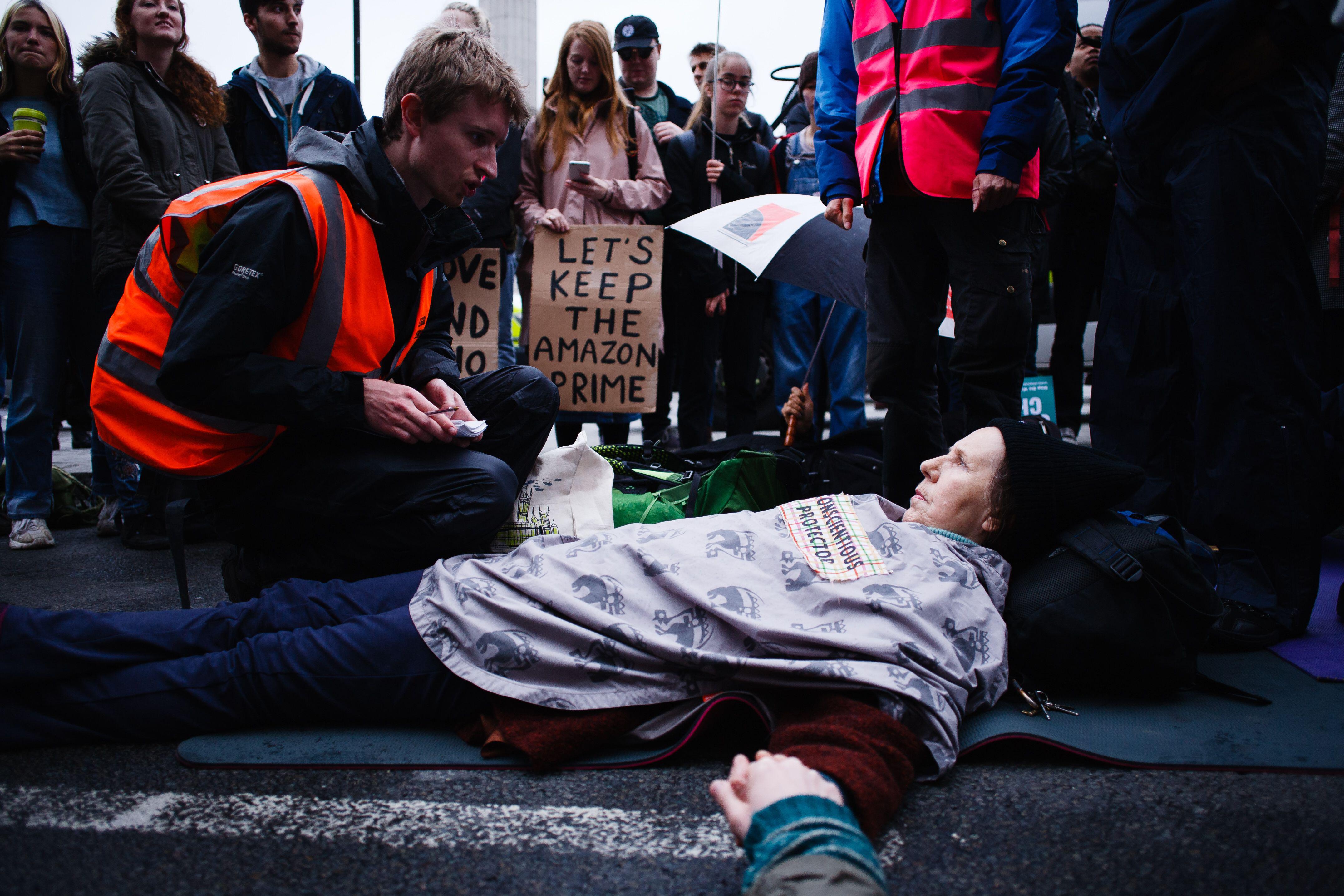
A CBS News analysis of the USGS data found that more than 67,000 people along the Eastern Seaboard live in communities exposed to rising sea levels, hurricanes and other hazards that could permanently change or erode the landscape of the coast in the next decade.
Some of the buildings in these areas are over 100 years old and include houses, businesses and places of worship. Change to the coastline could cause damage to homes, roads and other facilities and make a community potentially unlivable.
The analysis identified at least 45 seaports where the coastline could be permanently altered due to hazards like rising seas and erosion that could disrupt operations or close them for days.
A more detailed look at coastal impact
The USGS has published costal climate change predictions before, but in a change from previous iterations, the agency also included data about the physical makeup of the coast, like whether the surface was sandy, rocky, or anchored with foliage. These characteristics, along with the climate, help determine how susceptible an area might be to erosion or flooding.
"We're putting that all together in a sandwich, but we're doing it through machine learning," said Erika Lentz, a USGS research geologist.
The result is a highly detailed map that can predict how the coast might change. The National Park Service plans to use this data to create resiliency projects for the many buildings and tourist attractions they care for. In North Carolina, the Cape Hatteras lighthouse has been under the threat of erosion since the 1930's. In Cape Cod, the visitor center has already been impacted by flooding from storms and hurricanes.
The data could be used by other agencies like port authorities to concentrate climate resilience projects in vulnerable areas.
In addition to the more than 67,000 people at risk of displacement along the Eastern Seaboard, changes to coastal conditions threaten the dozens of seaports that line the busy northeastern coast.
The American Association of Port Authorities estimates that for every $1 billion in exports shipped through U.S. seaports, 15,000 jobs are created.
The analysis found that the Port of Boston is one of the most vulnerable areas. One of the oldest ports in the nation, it supports over 66,000 jobs.
Mapping the change along Boston's coast
Ports are often essential parts of a community and region's way of life. Many smaller ports are less crucial to national supply chains but can still support people and businesses across several states.
"Some ports like Providence maybe have a bit less value on that national scale or that global scale, but a really high value at the local scale," said University of Rhode Island professor Austin Becker.
Becker chairs the Marine Affairs Coastal Resilience Lab, which studies the hazards and problems climate change brings to coastal commerce. He said the vast majority of petroleum products for Rhode Island come through the Port of Providence.
"That leaves the region highly reliant on the port for fuel and oil for heating homes in the winter," said Becker.
Across the country, millions of jobs — the American Association of Port Authorities estimates 31 million — are supported by ports, either directly or indirectly, including jobs in warehouses, cruise line terminals and seafood processing centers. But even if the ports can maintain their costal integrity, rising sea levels make them more vulnerable to flooding.
CBS analyzed data on "high tide flooding" from the National Oceanic and Atmospheric Administration. It's a new term NOAA is using to describe the phenomenon of floods that occur even without hurricanes or storms.
In 2022, Boston Harbor saw 14 days of high tide flooding.
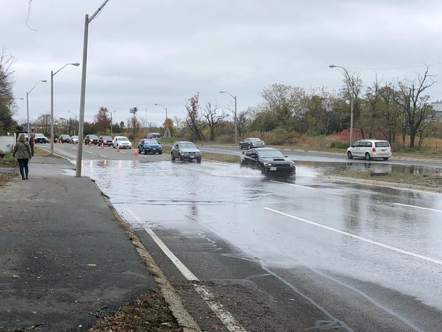
"What we're calling 'high tide flooding' at NOAA is increased frequency of minor flooding events. Sunny- day conditions — water in the streets. It's not necessarily damaging or destructive, but it's disruptive to communities," said William Sweet, a NOAA oceanographer.
The NOAA data predicts that flooding days could triple by 2050, with the Port of Boston and surrounding communities experiencing as many as 50 high tide flooding days every year. That's nearly two months of disruptive floods.
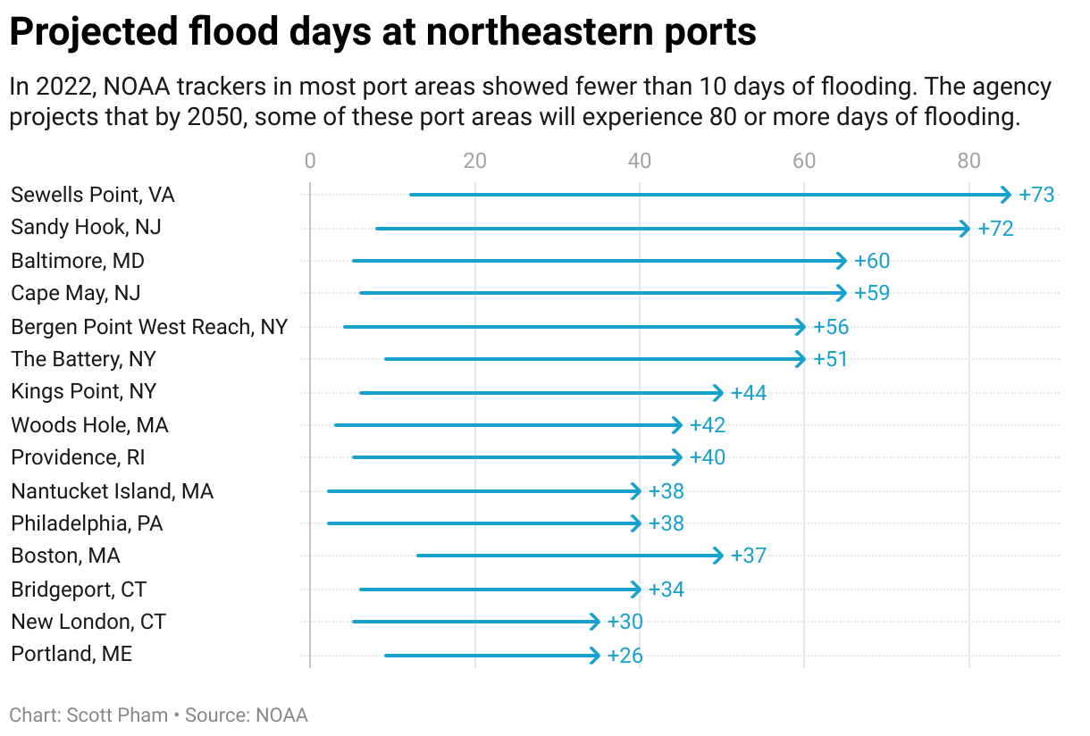
Ports up and down the Atlantic Coast have similar high tide flooding outlooks. The Port of Baltimore and surrounding areas are projected to be underwater for 65 days per year by 2050, compared to 3 days last year, while the Port of New York and New Jersey may experience 60 sunny-day flooding days, up from 13 in 2022.
According to recent research, it would cost between $19.5 and $26.6 billion just to elevate East Coast ports by 6 feet to accommodate rising seas and flooding in the future.
The Biden administration announced a federal grant program in November to fund capital improvement projects at select shipping terminals. Ten East Coast ports have received grant funding from the program so far.
"It seems that a lot of ports don't take the necessary measures because they don't really know how to go about adaptation." said Regina Asariotis, chief of policy and legislation for the United Nations' Conference on Trade and Development.
If ports make climate resiliency part of every decision, she said they can make progress by reinforcing certain parts of their infrastructure and leaving others in place. Vulnerable components like fuel storage or electrical facilities can be elevated or relocated further inland.
Interactive map of at-risk port cities
Hover over the seaport regions (in pink) to see how much area is at risk according to the latest USGS data.
Becker, the University of Rhode Island professor, says communities and governments around the ports will have to take some of the responsibility.
"The ports themselves are not always in a position to be able to make the necessary investment," he said. "It's really important that we, as a society kind of de-silo ourselves and really recognize that the risk of these impacts to ports distributes across a pretty wide swath of society."