How hurricane forecasts have improved since Katrina
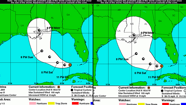
As Hurricane Katrina barreled towards New Orleans ten years ago, forecasters could see where it was heading. But there was still a measure of uncertainty, and not everyone heeded the warning. Officials delayed preparations and evacuation orders, and many residents hoped for the best, opting to wait out the storm. In the end, the death toll was much higher than it should have been.
The response was different seven years later, when forecasters predicted the path of Hurricane Sandy, and New York and New Jersey officials responded swiftly to evacuate low-lying areas.
What this illustrates, experts say, is that the ability predict the path of such storms with a high degree of accuracy has gotten markedly better in the past decade. That, in turn, has prompted mayors and governors, emergency management coordinators and average citizens to take action to get out of harm's way.
"Part of it is confidence," Chris Velden, a senior scientist and hurricane researcher at the University of Wisconsin, Madison, told CBS News.
"The public has to have confidence that the forecast won't only be good in one case but will be good all the time," he said. "In Katrina I think, in 2005, there was still enough uncertainty in the forecast, even though it was a good one, that they weren't ready to pull the trigger on an evacuation two days in advance. Had they done that, it would have saved a lot of lives."
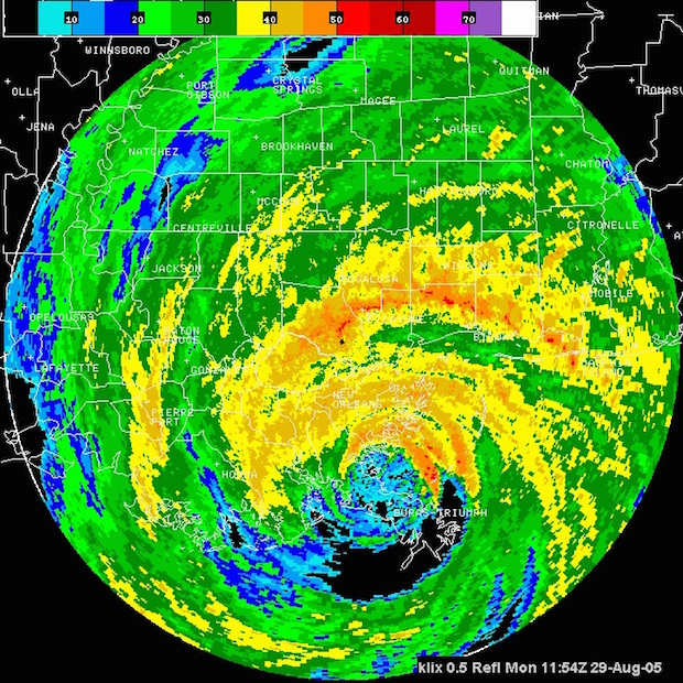
The year 2005 was among the busiest hurricane seasons on record, not only bringing Katrina to the Gulf Coast in August but also Rita, which hit Texas and Louisiana less than a month later, and then Wilma, which struck Florida's southwest coast in October. Over the course of that hurricane season, 4,000 people lost their lives - half of those in Katrina - and property damage reached nearly $160 billion.
The extent of the destruction and the heightened hurricane activity increased concerns about the dangers of hurricanes and prompted soul searching inside and outside of the National Oceanic and Atmospheric Administration over its ability to forecast these storms.
In 2008, NOAA launched a project to improve hurricane forecasts, vowing to increase the accuracy of storm tracking and intensity by 50 percent within a decade. While there are still several years left on the program, NOAA said forecasting has significantly improved.
Thanks to a network of GEO stationary and polar orbiting satellites providing better data, faster super-computers, and improved modeling, forecasters at NOAA's National Hurricane Center have been able to reduce the margin of error in predicting a hurricane's path by almost half. In 2005 the average seasonal tracking error in a 48-hour forecast of where a storm would end up was 110 nautical miles. Now it's 65 miles.
"We know we still have work to do, but I can say we're in a much better place now because of the investments made over the past decade," Kathyrn Sullivan, NOAA's administrator and the Under Secretary of Commerce for Oceans and Atmosphere, told reporters last month.
Not only has storm tracking become more accurate but James Franklin, the chief of forecast for the center, told CBS News that NOAA has been able in the past decade to increase the watch and warning times for hurricanes by 12 hours. Watches are now issued 48 hours in advance, and warnings come 36 ahead of the storm.
"As the computers get faster, the computer model's resolution increases, the ability to see higher and finer detail in the atmosphere increases. So as the models get better, our forecast errors go down," Franklin told CBS News.
"That, by itself, isn't enough," he continued "You can't run a computer model without telling it what the current state of the atmosphere is - the distribution of wind, temperature, moisture all over the globe - and that is what we call initializing the computer model. You have to get the model off to a good start so part of the key to improving predictions is better measurements of the atmosphere mostly from satellites."
Franklin also said the forecasts themselves have changed, partly inspired by Hurricane Charley in 2004, which deviated slightly from its predicted track and unexpectedly made landfall in Port Charlotte, Florida. Instead of focusing only on the exact line the hurricane is tracking, NOAA now emphasizes a broader area in its forecast and also calculates the chances that someone will experience tropical storm winds or a storm surge at their location.
"We needed to come up with a better way of conveying the risk and, in particular, the uncertainty in our forecast. We know the forecast will have an error," Franklin said. After Hurricane Charley, "we began a concrete effort to put out a probabilistic forecast that went beyond here is the (storm) track and exactly where it is going."
Still, some experts said the public sometimes has a hard time weighing those risks and, as a result, often waits until the last minute to take necessary measures like evacuating when a storm is approaching.
"Communication of the threat posed by storms is only beginning to improve slowly. We are just starting to understand how people perceive risk and how they make decisions," Chris Davis, a hurricane expert at the National Center for Atmospheric Research, said. "Products like storm surge maps are challenging for the public to interpret because surge is extremely dependent on highly accurate track forecasts. A small error in track can wreck a surge forecast. Probabilistic forecasts are crucial, but communicating such forecasts is a big challenge."
Another challenge is forecasting the intensity of a hurricane, which has only seen slight improvements. Hurricane experts said part of the problem is that intensity requires data from inside the hurricane, which is harder to get than the data required to forecast the storm's track.
"The intensity of a hurricane is very much tied to the inner core, the smaller scale structure - what is going on in the eye wall," Velden said. "The satellite is not as good in most cases. Especially 10 years ago, the satellites were not as able to see those kind of structures."
Velden said forecasters relied on hurricane hunters to fly into the storms to gather data, but as late as 2005 that information wasn't even making it into the the models or computer equations that simulate the atmosphere. It is now, after NOAA launched an effort to "accelerate the use of this data."
"If you come along and you get actual data that the hurricane hunters can provide, the model isn't going to accept that data right away. It is foreign to it," Velden said. "A lot of R&D, a lot of development work has to be done for the models to accurately accept that data, get it into the initial analysis of the conditions. Then, that is what will ultimately lead to better forecasts. I think we are still in the process."
Franklin agreed intensity forecasting has not improved as much as storm tracking. Even developing models for this can be difficult since the physics behind the formation of tropical storms is less understood and more complicated compared to how a storm moves.
"Hurricanes get their energy from the ocean. In order to model that process, the model has to be able to replicate how energy is going to flow from the ocean to the atmosphere," he said. "It depends on the wind speed. It depends on the waves. It depends on temperature differences between the ocean and the atmosphere. It depends on a lot of things."
Still, forecasters have gained a better understanding of what makes hurricanes tick since Katrina.
They long thought that hot towers - tall thunderstorms clouds that carry heat upwards - were critical to a hurricane's intensity. But now forecasters have found these towers may not be as important as the quantity and location of drafts of rising air, or updrafts, inside the cyclone - especially between the center of the cyclone and the band of its strongest winds.
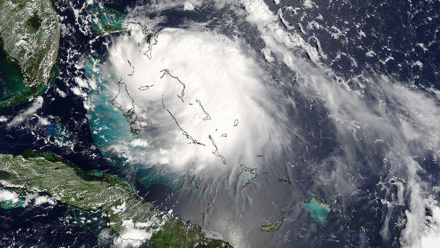
Scientists including those at NASA's Goddard Space Flight Center also are focusing more attention on the factors that can weaken a hurricane, especially wind shear - a large change in winds at significant heights - that can tear apart a storm before it has a chance to form into a hurricane. Wind shear was a factor in the weakening of Hurricane Danny, the first hurricane of the 2015 Atlantic Hurricane Season.
"It used to be that we always looked for the mechanisms that allow hurricanes to rapidly intensify, but as of late, the question has gotten flipped around," said Scott Braun, a research meteorologist at Goddard. "Now we ask what are the factors that prevent a hurricane from intensifying."
All this demonstrates just how difficult it can be to get these forecasts spot on. Asked if forecasters will ever reach the point of 100 percent certainty, Franklin said he doubted it.
"The atmosphere is chaotic. Small errors grow, small differences grow," he said. "For that reason, there are limits as to how good we can be. We will never, never be able to measure all across the globe at all levels at all places exactly. We can't do it."