Pamela forecast to intensify into hurricane and bring life-threatening flooding to parts of Mexico and Texas
Tropical Storm Pamela is expected to be "near major hurricane strength" by the time it makes landfall Wednesday morning on the west-central coast of Mexico, the National Hurricane Center said Tuesday in a public advisory. The storm is expected to concoct "life-threatening" storm surge, dangerous winds, heavy rains and a threat for "significant and life-threatening flash flooding and mudslides" across affected areas.
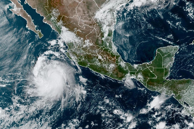
Located in the Pacific Ocean, Pamela is moving north and expected to continue in the general direction throughout the afternoon, followed by a faster northeastward motion Tuesday night, according to the National Hurricane Center.
The storm has maximum sustained winds of nearly 80 miles per hour with even higher gusts. The center forecasts "steady strengthening" to occur Tuesday night into early Wednesday morning. The storm is expected to pass south of Baja California's southern tip overnight Tuesday before making landfall in Bahia Tempehuaya to Escuinapa — which is currently under a hurricane warning — in west-central Mexico.
"Pamela could be near major hurricane strength when it reaches the coast of Mexico Wednesday morning," the center said.
Tropical storm warnings are in effect for north of Bahia Tempehuaya to Altata, south of Escuinapa to Cabo Corrientes and Islas Marias. A tropical storm watch is in effect for Los Barilles to Cabo San Lucas.
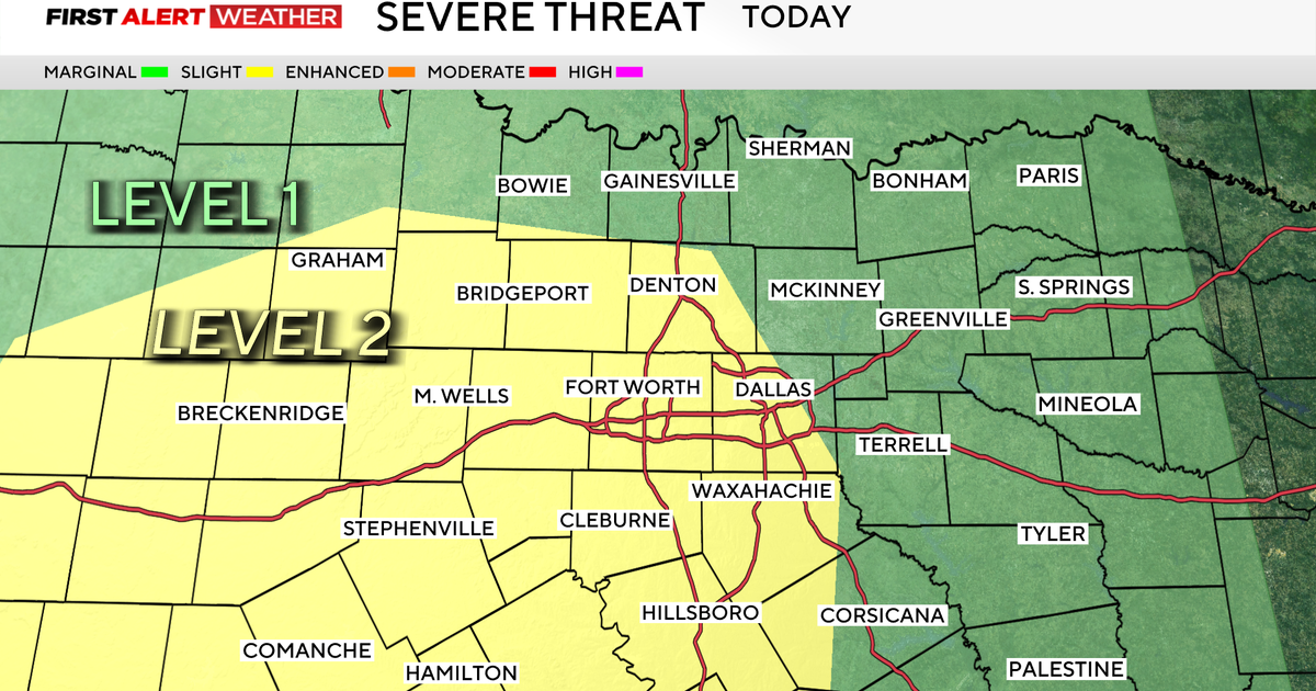
Parts of central Texas and southeastern Oklahoma are expected to see heavy rainfall associated from the hurricane late Wednesday and Thursday, which may result in flash and urban flooding, forecasts predict. The center said an isolated maximum total of 8 inches of rain for the area is possible.
The center advised residents in affected areas to consult their local weather offices in preparation for the potentially "life-threatening surf and rip current conditions," as well as the "large and destructive" storm surge waves which may cause coastal flooding.