Google Maps now look better than ever
Google Maps just got a makeover. In a blog post Monday, Google announced it is rolling out a more vivid look at the world through Google Earth thanks to new imagery from the Landsat 8 satellite and new and improved processing techniques that make for sharper images.
"Satellite images are often cloudy, but not always over the same place, so we looked at millions of images and took the clearest pixels to stitch together this cloud-free and seamless image," the post reads.
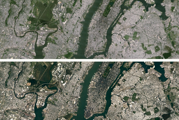
Comparing old and new images reveals a sharp difference. In the photos below, the older view of Manhattan (top photo) looks hazy compared to the clearer and more detailed image from Landsat 8 (bottom photo).
For those not in the know, Landsat 8 is part of the USGS/NASA Landsat Program and was launched into orbit around Earth back in 2013. The satellite captures twice as many images per day as the Landsat 7. Google said that thanks to this technology, users can now see the "freshest global mosaic to date."