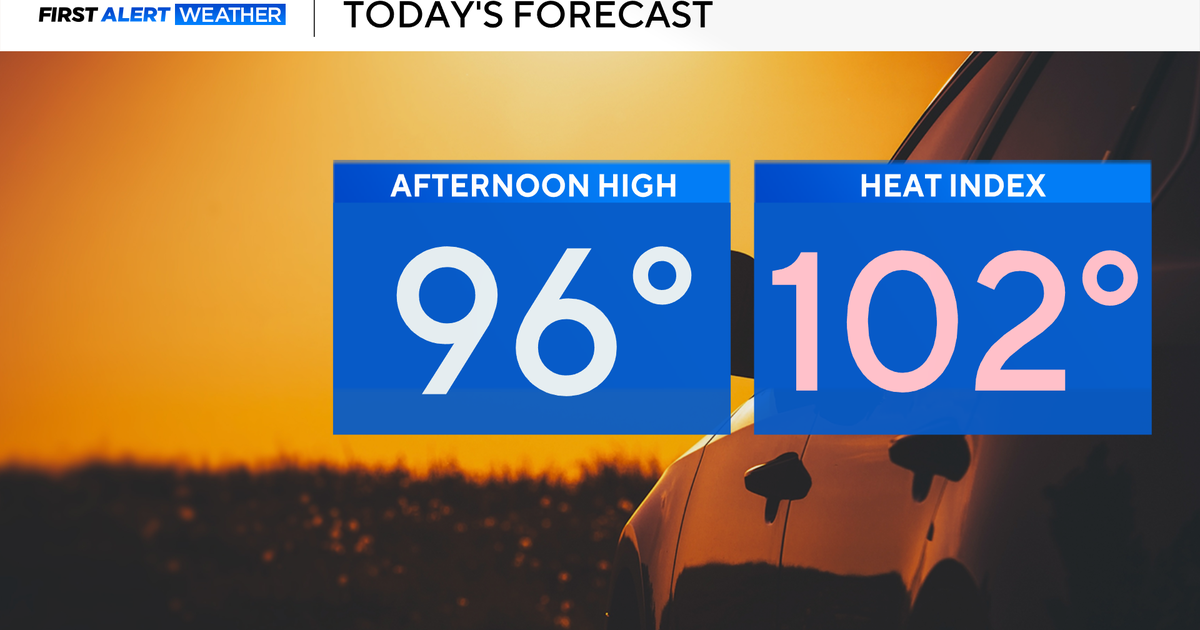
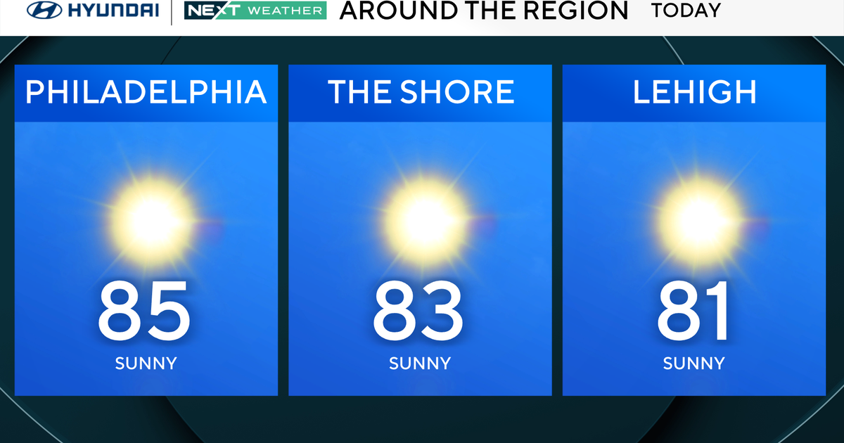
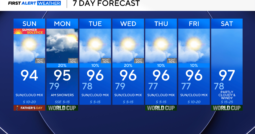
NEXT Weather: Cool sunshine Wednesday, multi-day storm arrives Thursday
MINNEAPOLIS – Wednesday will bring cool sunshine, before a multi-day storm system arrives and lingers into the weekend.
Temperatures will fall into the low teens Wednesday morning in the Twin Cities, and into the single digits in some suburbs, but it will feel closer to zero due to the winds.
Highs across Minnesota will be stuck in the 20s Wednesday. The metro's high of 29 will be almost 20 degrees below average, but the dominant sunshine should still help melt more snow.

Thursday's high in the metro will be 41, but a big storm system is headed our way, bringing both rain and accumulating snow.
The system will enter northwestern Minnesota early Thursday morning, and reach the metro in the form of rain just after lunchtime. It will be in the form of snow up north.
There will be a lull in the storm early Friday, before it returns to the metro as wet snow during the evening commute. Much of it will melt on contact, but it will keep on falling through Saturday morning, so expect some slushy accumulation. Don't bother shoveling it. Mother Nature will do the clearing for you.
Saturday will be sunny with a high of 39, and Sunday may be the first 50-degree day since Nov. 26 of last year.
More rain and snow is possible early next week.