South Florida stays hot as chances for tropical development grow in Atlantic

It was a soggy start to Tuesday across parts of South Florida due to some showers and thunderstorms that moved through.
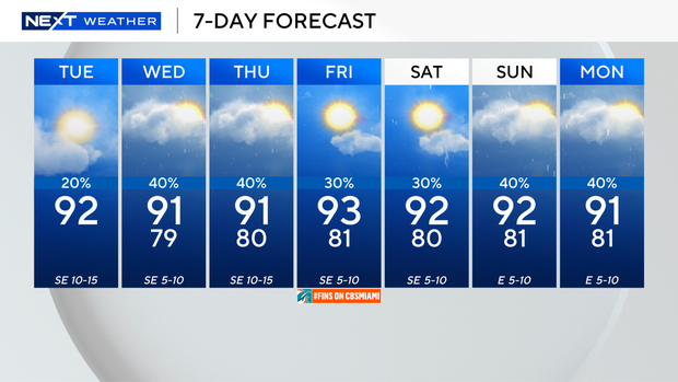
High temperatures will climb to the low 90s this afternoon, and it will feel like the upper 90s and 100s when you factor in the humidity.
Spotty thunderstorms will develop around midday and during the afternoon hours.
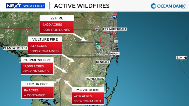
The 22 Fire, the Vulture Fire and the Movie Dome fires are contained now. But the Chipmunk Fire, which has burned around 17,000 acres, is 60% contained. The Lemur Fire has burned 116 acres.
Some of the smoke from these fires will lead to hazy conditions and lower air quality likely on Tuesday morning before the smoke is steered inland and out west by the onshore breeze.
There is a low risk of rip currents along our Atlantic beaches and the UV index is extreme. There are no alerts or advisories for boaters along the Atlantic waters or the Keys waters.
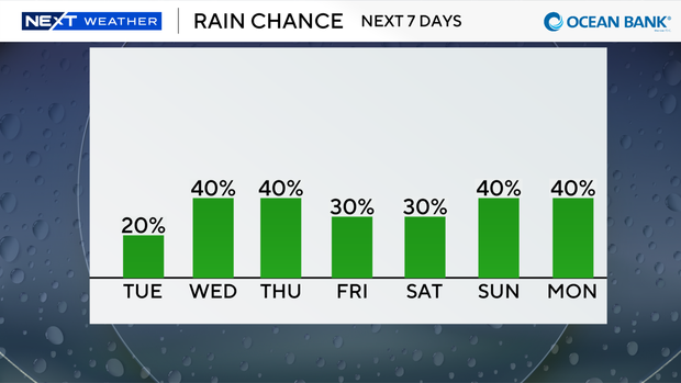
The chance of rain is higher on Wednesday with more widespread showers and storms possible. Highs remain near normal in the low 90s.
Scattered storms will develop every day as we settle back into a rainy season pattern to end the week. The rain chance is a bit lower on Friday and Saturday.
The CBS News Miami NEXT Weather team is tracking two areas in the tropics.
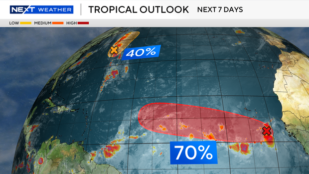
An area of low pressure located a few hundred miles east-northeast of Bermuda is moving northward to north-northeastward at 15 to 20 mph.
This system has a medium potential of cyclone development and could still become a short-lived tropical depression or storm later today before encountering increasingly hostile conditions tonight and Wednesday, likely ending its chances for development.
In the eastern Atlantic, an area of low pressure centered a few hundred miles south-southeast of the Cabo Verde Islands has a high potential of development.
Environmental conditions appear conducive for gradual development, and this system is likely to become a tropical depression during the next day or two while it moves westward to west-northwestward across the eastern and central tropical Atlantic.