Flood advisories canceled Thursday afternoon in Miami-Dade, Broward counties


Flood advisories were canceled Thursday afternoon for parts of northern Miami-Dade County and central Broward County as heavy rain has moved out most of South Florida.
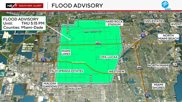
In Miami-Dade, the original advisory ran until 5:15 p.m. Areas affected include Hialeah, Miami Gardens, Miami Lakes, Opa-Locka, Country Club, Westview, Hard Rock Stadium and Saint Thomas University.
Doppler radar showed heavy rain from thunderstorms as of 3:21 p.m., with between 1 and 3 inches already on the ground. Forecasters expect an additional 1 to 3 inches before the advisory expires.
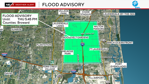
In Broward County, the advisory was in effect until 5:45 p.m. and covered a wide stretch of central Broward, including Fort Lauderdale, Oakland Park, Lauderdale Lakes, Wilton Manors and surrounding communities.
Radar there showed heavy rain as of 2:39 p.m., with 1 to 2.5 inches already fallen. Another 1 to 2 inches are expected.
In both counties, forecasters were warning of minor flooding in low-lying and poorly drained areas, water over roadways, and overflowing drainage systems.
Drivers should still use caution on local roads and avoid flooded areas where possible.
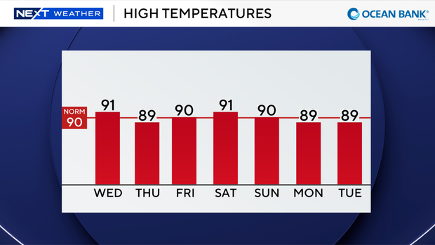
It's also going to be another hot and humid day across South Florida, with forecast high temperatures in the low 90s. But it will feel like the upper 90s and 100s when you factor in the humidity.
There is a low risk of rip currents on Thursday, and the UV index is at an extreme level.
There are no alerts or advisories for boaters over the Atlantic water or Keys waters.
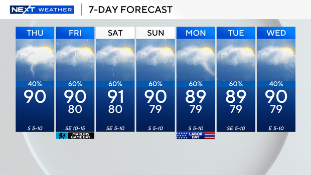
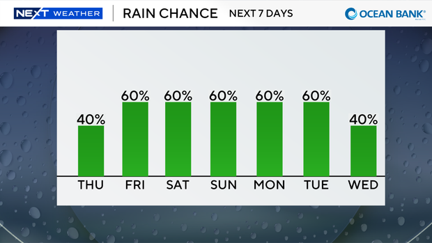
The chance of seeing showers and thunderstorms will remain elevated through the Labor Day holiday weekend due to plenty of moisture around.
We will see daily scattered storms with the potential for heavy rain at times.
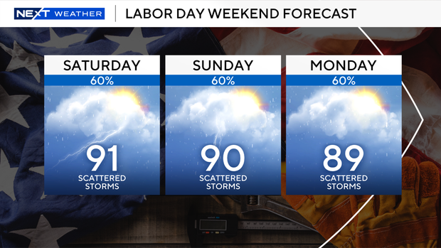
High temperatures will remain seasonable in the low 90s, and be sure to keep the rain gear close – even through Labor Day.
The CBS News Miami NEXT Weather team is also continuing to track the remnants of Edouard soaking parts of Texas.
Flash flooding and river flooding will be possible. The National Hurricane Center says tropical development is not expected over the next seven days.