Spotty showers, storms possible in South Florida ahead of taste of fall weather this weekend

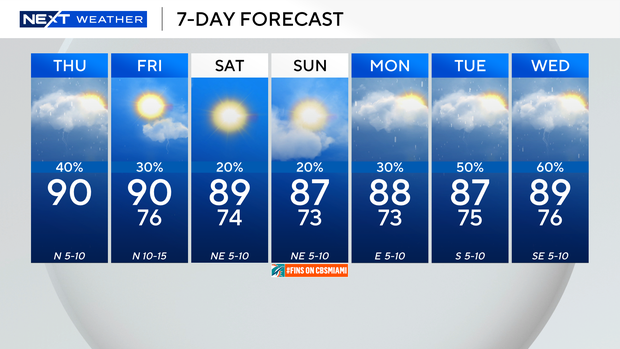
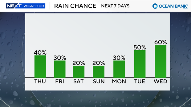
It was a dry start to the day across South Florida on Thursday, and while lower rain chances are on the way, there is still a possibility that showers and storms could develop later in the afternoon.
Thursday is expected to be a transitional day as the rain coverage won't be as widespread or as intense as the last few days.
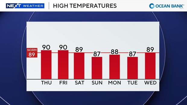
High temperatures will climb to about 90 degrees on Thursday afternoon.
There is a moderate risk of rip currents along the Atlantic beaches, but that risk will be higher heading into the weekend.
There are currently no alerts or advisories for boaters over the Atlantic waters or Keys waters on Thursday, but a small craft advisory will go into effect on Friday due to hazardous boating conditions.
Spotty showers and thunderstorms will be possible on Friday afternoon, and temperatures will be near 90 degrees.
A nor'easter will bring coastal flooding, high surf, wind and rain to parts of the East Coast through the weekend. The front associated with the low-pressure system will usher in some drier air for us here in South Florida and will bring us a taste of fall.
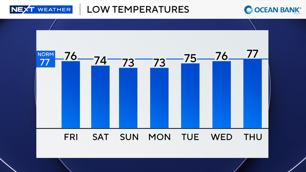
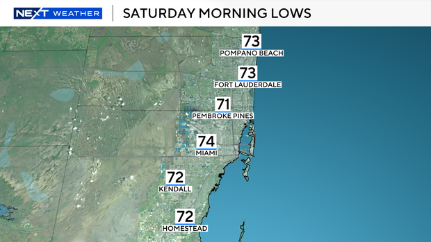
This weekend, our morning low temperatures will drop into the low to mid-70s in Broward and Miami-Dade on Saturday and Sunday.
High temperatures will climb into the mid- to upper 80s, but it will feel much more comfortable with lower humidity.
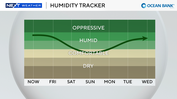
The chance of rain will rise along with the humidity from the early to middle of next week.
The CBS Miami Next Weather team is tracking a broad area of low pressure located a few hundred miles south-southeast of the Cabo Verde Islands with a high potential of development.
The National Hurricane Center says this system could become a short-lived tropical depression or a tropical storm later on Thursday or on Friday while it moves northwestward or northward.
Gusty winds, heavy rain and flash flooding will be possible over the Cabo Verde Islands by Friday.