Dry conditions to move into South Florida after wet, stormy night led to flooding

It was a soggy start to the day in South Florida as heavy rain and thunderstorms moved through the east coast metro areas overnight.
Flood advisories were issued after rain amounts between 3 and 4 inches were estimated by radar along the coast from northern Miami-Dade to southern Broward.
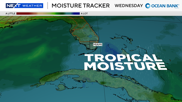
Rain will continue to fall on Wednesday morning along the coast, but it won't be as intense as the storms overnight.
Light to moderate rain with an occasional downpour remains in the forecast through Wednesday morning before it moves off the coast Wednesday afternoon.
This will then mark the beginning of a change in our weather pattern for South Florida and the Florida Keys.
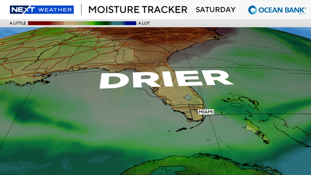
Skies will clear up later Wednesday afternoon as dry air begins to move into the region from up north.
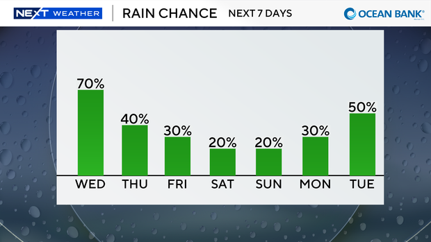
This will lower the rain chances starting Thursday and continuing through the weekend.
Along with lower rain chances, the humidity will also be noticeably lower, especially north over Broward County.
With a little more sunshine, temperatures will remain in the upper 80s and may be able to touch 90 degrees briefly.
The breeze continues from the north over the next few days with an occasional shower or thunderstorm.