Drier forecast expected after flash flood warning in Broward expired Monday evening


A Flash Flood Warning was in effect for central Broward County until 6:45 p.m., with drier weather expected for the rest of the evening.
Doppler radar showed thunderstorms dropping heavy rain across the area as of 5:12 p.m. Between 3 and 5 inches of rain had already fallen, with an additional 2 to 4 inches possible before the warning expired.
Streets, highways, underpasses, small creeks and streams, and low-lying areas were all at risk. Communities in the warning zone include Sunrise, Tamarac, Margate, Lauderhill, Oakland Park, North Lauderdale, Lauderdale Lakes, Broadview-Pompano Park, Village Park, Palm Aire and Rock Island.
Families are urged not to drive through flooded roads. Most flood deaths occur in vehicles, forecasters said.
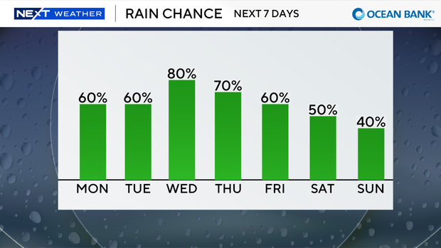
The chances of seeing rain and thunderstorms will be highest on Monday afternoon.
An upper-level low is helping to pump in deep tropical moisture, and a southwesterly flow will help to steer much of the wet weather along our east coast metro areas.
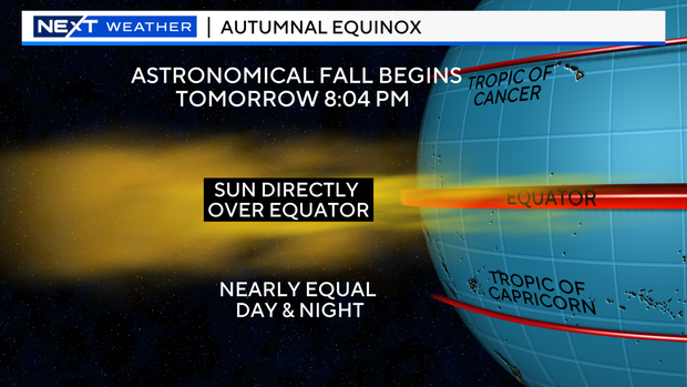
Tuesday marks the start of astronomical fall as the Autumnal Equinox takes place at 8:04 p.m.
This is the moment when the sun crosses directly above Earth's equator, moving south into the celestial sphere.
The word equinox comes from Latin words meaning "equal night" because day and night are nearly equal in length. Daylight hours grow shorter and nights grow longer until the winter solstice in December.
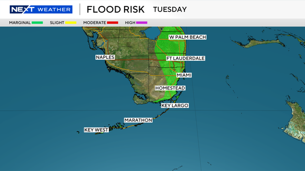
The Weather Prediction Center has placed South Florida under a marginal risk, a level 1 risk, of excessive heavy rainfall through Wednesday due to the potential for heavy downpours and localized street flooding.
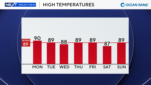
The chance of rain will stay high most of the week. And with the rain and clouds around, high temperatures will not be as hot with the upper 80s the rest of the week.
The CBS News Miami NEXT Weather team is tracking Tropical Storm Fay located about 405 miles southwest of the Azores.
Fay is weakening and moving very slowly toward the south-southeast near 2 mph. Fay is now forecast to remain a tropical storm likely through tomorrow.
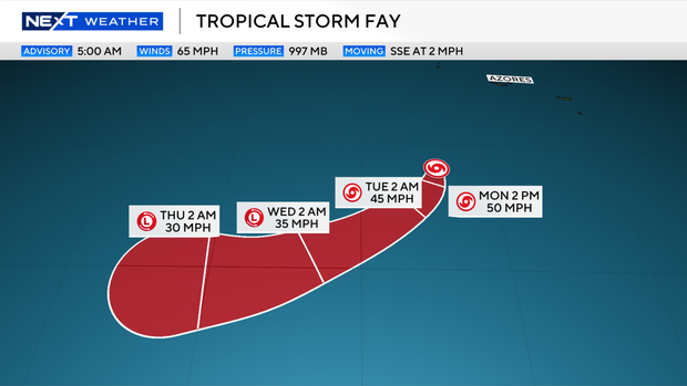
It is expected to move to the southwest during the next few days.
The National Hurricane Center says Fay could degenerate to a post-tropical cyclone in a day or two.