Scattered storms could bring heavy rain, lightning to South Florida after steamy start to day

Some showers blew in on the breeze on Wednesday morning across parts of South Florida as we woke up to a steamy start with feels-like temperatures in the low 90s for many neighborhoods.
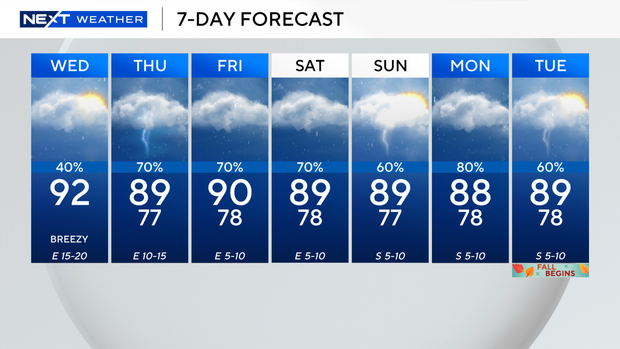
On Wednesday afternoon, high temperatures are expected to climb into the low 90s, and it will feel like the upper 90s and low 100s when you factor in the humidity.
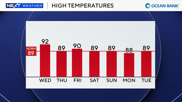
The winds are expected to increase out of the east on Wednesday and could reach 15 to 20 mph during the afternoon and evening hours.
Wind gusts could be even higher later Wednesday night.
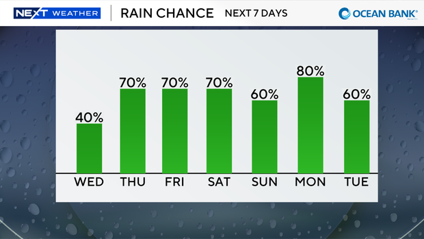
Scattered thunderstorms are also expected to move in later Wednesday, and heavy downpours, lightning and gusty winds will be possible.
There is a moderate risk of rip currents along our Atlantic beaches due to the onshore flow. If you're headed to the beach, use caution and swim near a lifeguard.
There are no alerts or advisories for boaters over the Atlantic waters or Keys waters.
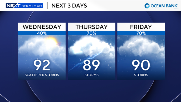
The chance of rain is rising on Thursday and the rest of the week due to deeper moisture and an upper-level low pressure system.
Daily scattered to numerous storms can be expected through the weekend.
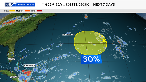
The CBS Miami Next Weather team is tracking an area of low pressure in the Atlantic located several hundred miles east of Bermuda.
Environmental conditions could become a little more conducive for development in a couple of days while this system moves slowly westward to west-northwestward.
The National Hurricane Center says this area has a low potential, a 30% chance, of development over the next 7 days.