South Florida to see increasing risk of showers, thunderstorms this week

The east breeze returns to South Florida, keeping showers in the forecast throughout the day.
Numerous showers will continue to develop each morning and move through the metro areas and the Keys throughout the day. By the afternoon, the majority of the showers and storms will be over the interior but a few isolated storms may linger along the east coast.
A front moving south through the state will stall just to the north and keep the breeze and moisture in place Wednesday.
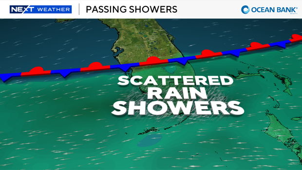
Along this front, an area of low pressure will develop above the surface and keep our weather unsettled through the end of the week and the weekend.
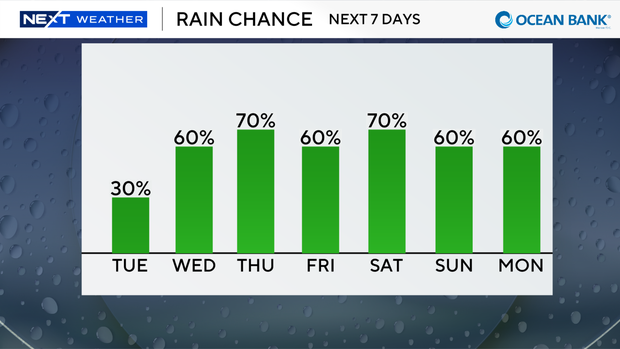
Rain chances start at 30% today before climbing to 60% Wednesday, 70% Thursday and staying elevated into the weekend, topping out at 70% Saturday.
Deep moisture will fuel numerous storms Thursday into Friday, with some spots seeing repeat rounds as storms train over the same areas.
A few of the storms that develop under this area of low pressure may be strong with gusty winds and small hail.
By early next week, the low should finally push west, and South Florida returns to its more typical sea-breeze-driven pattern with scattered afternoon storms.
There is one area to watch in the tropics for possible development east of Bermuda. It's a medium development potential and will remain over open water should there be any development over the next 7 days.