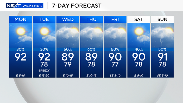
South Florida sees sunny start to new workweek, but rain chances are set to increase

It was a mostly sunny start to the new workweek across South Florida with the exception of a few showers that popped up across portions of the Florida Keys.
South Florida could see some spotty showers and thunderstorms during the afternoon hours, but most of the rain will be focused over inland areas due to the east breeze.
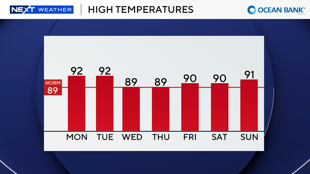
High temperatures are expected to climb into the low 90s on Monday afternoon, and it will feel like the upper 90s and low 100s when you factor in the humidity.
Some minor saltwater flooding is also possible due to higher-than-normal king tides.
There is a low risk of rip currents along our Atlantic beaches, and the UV index is very high. There are no alerts or advisories for boaters over the Atlantic waters or the Keys waters.
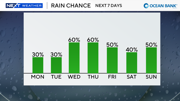
The chance of rain stays low through Tuesday as we will have some relatively drier air in place.
But more moisture moves mid to late week to raise our rain chances.
Daily scattered storms will be around through the weekend. Highs will remain near 90 degrees.
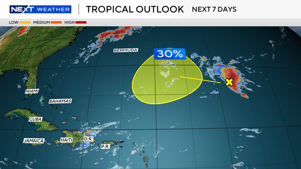
The CBS Miami NEXT Weather team is tracking a trough of low pressure located a little more than 1,000 miles east-southeast of Bermuda.
Currently, conditions are unfavorable for development due to strong upper-level winds.
The National Hurricane Center says there is a low potential, a 30% chance of development as this system moves west-northwestward across the central part of the subtropical Atlantic by the middle to latter portion of this week.