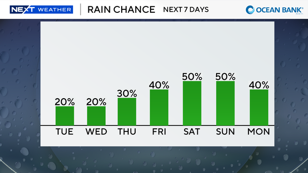
South Florida sees some showers Tuesday, but rain chances rise by end of week

Spotty showers were blowing in on the breeze on Tuesday morning in parts of South Florida, with most of the rain rolling in across Miami-Dade.
We are also enjoying a taste of fall with slightly cooler and more comfortable temperatures in the low to mid-70s to start the day.
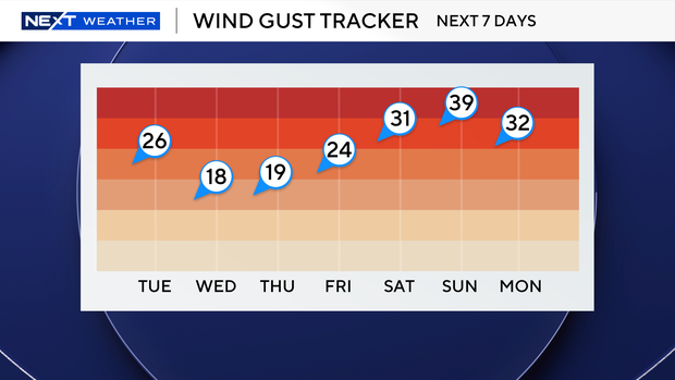
On Tuesday afternoon, temperatures are expected to climb into the mid-80s.
The breeze will build and gusts could reach 25 to 30 mph. It's also expected to be blustery at times.
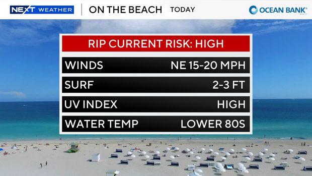
The strong onshore winds are also leading to a dangerous high risk of rip currents along our Atlantic beaches. That high risk of rip currents will likely continue through Friday.
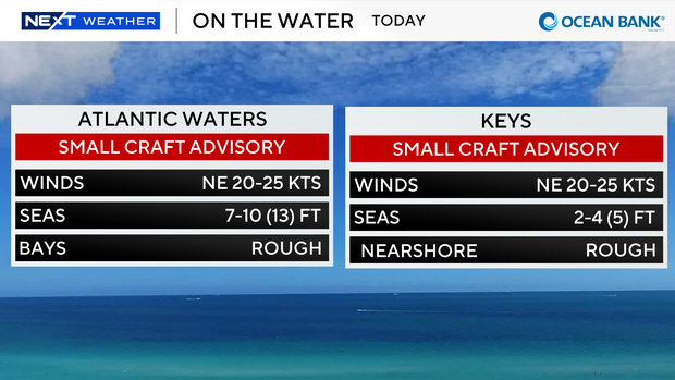
A small craft advisory is also in effect for the Atlantic waters and Keys waters due to the hazardous marine conditions.
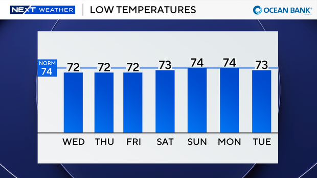
Wednesday morning is expected to be even cooler with low temperatures falling into the upper 60s inland and the low 70s closest to the coast.
We will stay breezy but not as blustery on Wednesday with a few showers possible.
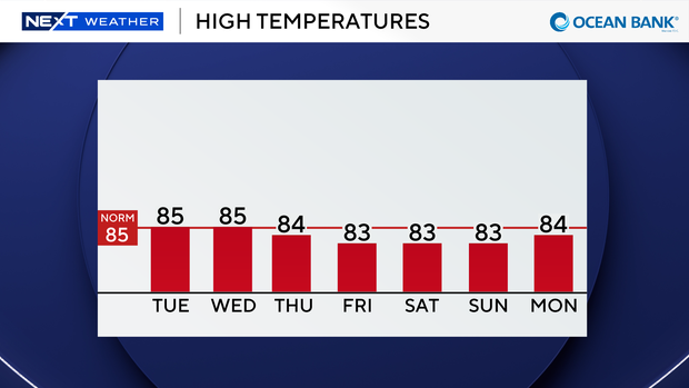
Wind gusts could still reach 15 mph to 20 mph. High temperatures will climb into the low 80s.
We will continue to enjoy a pleasant morning with temperatures in the low 70s and upper 60s for the rest of the week.
High temperatures will remain in the low 80s through the weekend.
Passing showers will be possible on Thursday, but rain chances will be higher late week and especially into the weekend with more scattered showers and thunderstorms around.