Windy, drier week ahead of taste of fall South Florida style

It's expected to be a windy but dry week across South Florida ahead of an enjoyable taste of fall with some pleasant mornings starting on Tuesday.
As a frontal boundary stalls out over the Florida straits, a drier air mass is settling in across the Sunshine State.
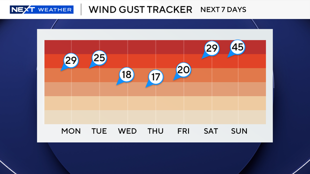
On Monday, winds will be sustained out of the northeast 20 to 25 mph, with gusts of up to 30 mph possible.
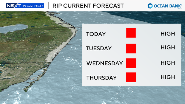
The strong onshore winds are leading to a dangerous high risk of rip currents along our Atlantic beaches through Thursday.
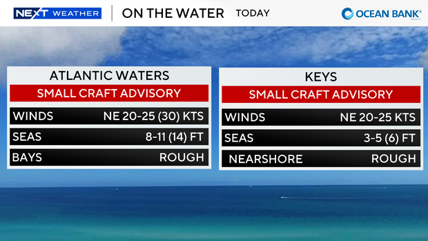
A Small Craft Advisory is in effect for the Atlantic waters due to northeast winds of 20 to 25 knots with gusts up to 30 knots, seas of 8 to 11 feet (up to 14 feet) and rough conditions nearshore.
A Small Craft Advisory is also in effect for the Florida Keys due to hazardous marine conditions.
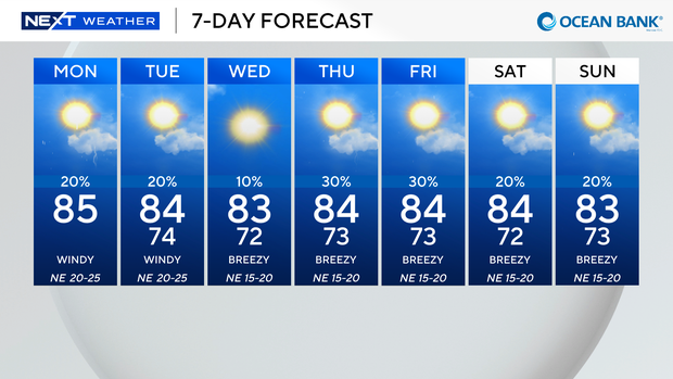
Today we'll enjoy mostly sunny and mainly dry conditions with lower humidity and highs in the low to mid 80s.
The chance of rain is low but a few showers may blow in on the breeze.
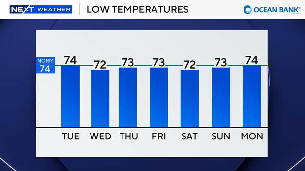
Tonight into tomorrow morning, lows will be slightly cooler and more comfortable in the low 70s.
Spotty showers will sweep in on the breeze mainly in the morning. Highs will continue in the low 80s and the gusty breeze sticks around.
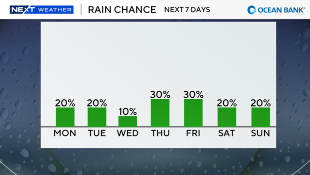
Wednesday will be the driest day of the week with even lower rain chances.
Just a few stray showers will be possible.
It will not be quite as windy but the breeze will be out of the northeast 10 to 15 mph with gusts of 20 to 25 mph.
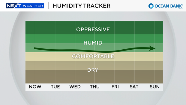
Late week the chance of rain will increase a bit with the potential for scattered showers.
Lows will remain pleasant in the low 70s and highs in the low 80s through the weekend.