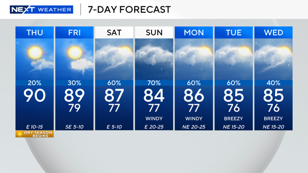
Spotty showers possible in South Florida Thursday before heavy rain, flood threat arrives this weekend

The dry season kicks off Thursday with mainly dry and breezy conditions across South Florida, and there is an isolated chance of seeing some showers during the day.
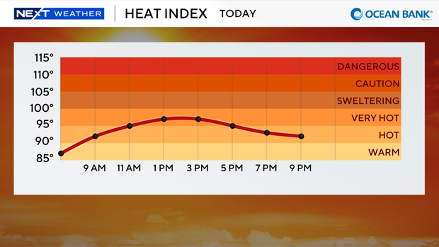
It was a warm, steamy start to the day with feels-like temperatures in the low 90s across the Florida Keys and in Broward and Miami-Dade counties.
It will be mostly sunny on Thursday with high temperatures near 90 degrees.
Stay hydrated as heat indices will soar into the upper 90s and 100s in the afternoon hours when you factor in the humidity.
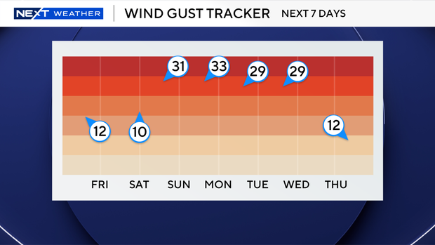
The east breeze will build on Thursday with gusts of 15 to 20 miles per hour.
There is a low risk of rip currents along our Atlantic beaches, and there are no advisories or alerts for boaters.
As we head into the weekend, winds will increase and lead to hazardous beach and boating conditions.
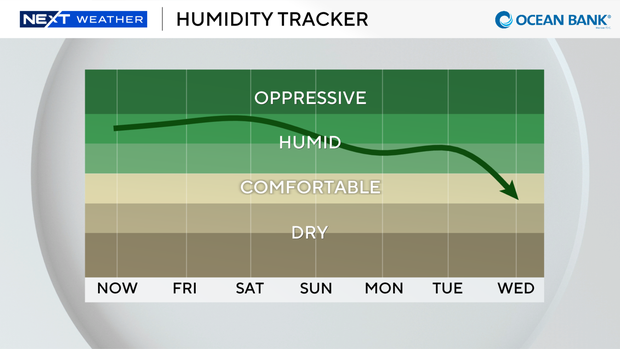
On Friday, spotty showers will blow in on the breeze. Highs will rise to the upper 80s, and it will feel like the upper 90s.
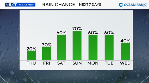
This weekend will be wet and windy due to a frontal boundary, plenty of moisture and high pressure. Saturday is looking soggy with scattered storms that could produce some heavy downpours.
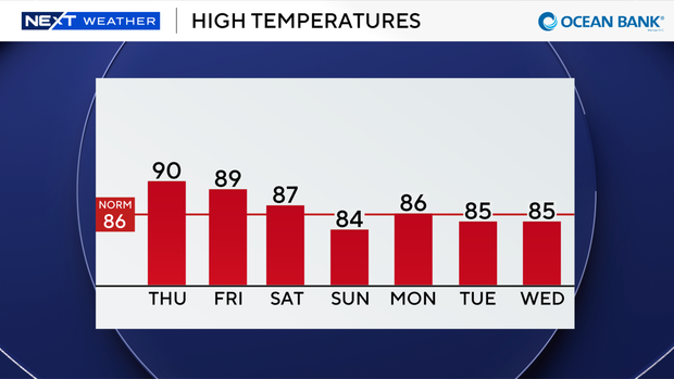
The chance of rain is even higher on Sunday with more widespread storms and the potential for heavy rain and localized flooding.
It will turn blustery at times with gusts possibly reaching 30 miles per hour or higher.
We stay unsettled with high rain chances through early next week.