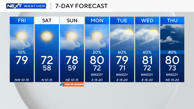
Clouds remain across South Florida before big temperature changes this weekend

A chilly change is on the way across South Florida, so get ready to break out the sweaters this weekend.
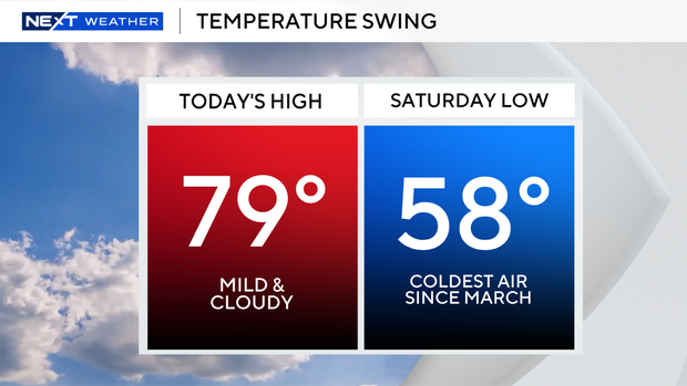
We woke up with a mild start to the day on Friday morning, and high temperatures will not be as warm this afternoon.
It's only expected to get into the upper 70s with clouds.
There is a low risk of rip currents along our Atlantic beaches. A small craft advisory will go into effect on Friday night through Saturday for boaters along the Atlantic waters and the Florida Keys.
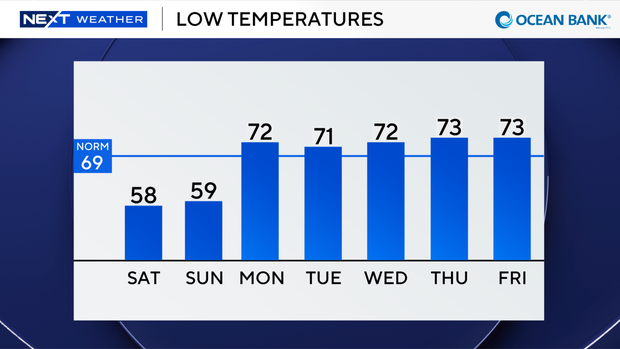
Once the cold front moves in later on Friday, temperatures will tumble Friday night into the upper 50s and low 60s.
This will be the coldest air of the season so far, and the coldest lows we've seen since March.
Our average low temperature is 69 degrees. Highs will struggle to reach the low 70s on Saturday afternoon with bright sunshine and a brisk breeze.
Still a chill in the air on Sunday morning, with low temperatures in the upper 50s and low 60s.
High temperatures will climb into the upper 70s under mostly sunny skies.
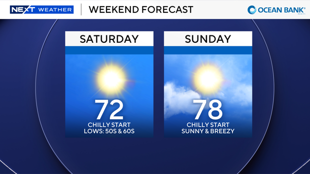
Winds could gust as high as 20 mph.
Temperatures and rain chances will rise early to middle of next week. Highs will be near 80 degrees on Monday with the potential for some spotty showers.
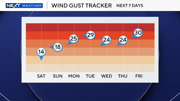
Winds will increase out of the east 15 to 20 mph with gusts as high as 25 to 30 mph.
Keep the umbrellas handy on Monday and Tuesday as scattered showers and thunderstorms will be possible. High temperatures will remain near 80 degrees and the windy weather sticks around with wind gusts as high as 25 to 30 mph.