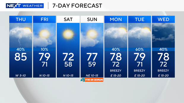
Showers, thunderstorms to develop in South Florida today ahead of big temperature drop

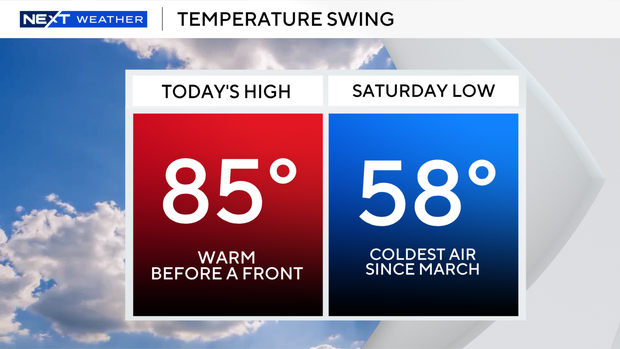
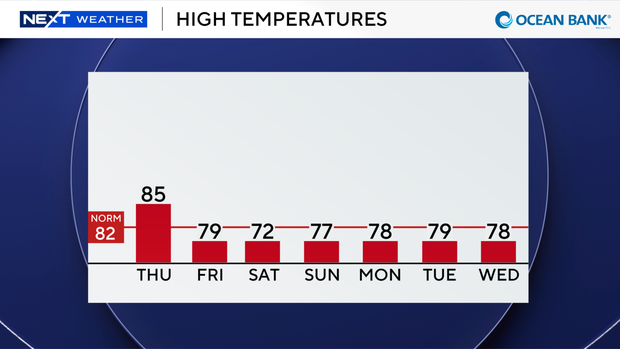
Final warm day with highs in the 80s before a couple of cold fronts move in.
Scattered showers and storms will develop later today due to a weak front that will bring some moisture with it.
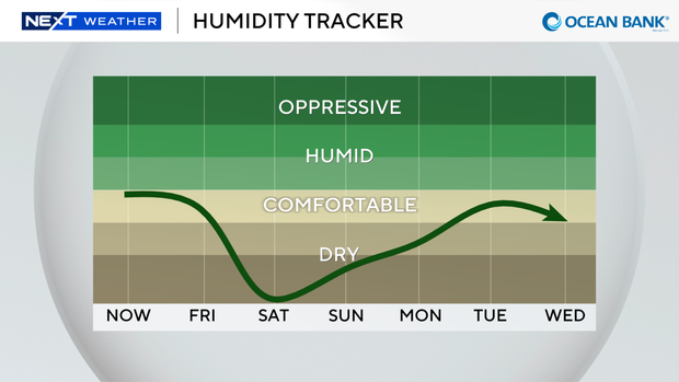
Tomorrow temperatures will begin to drop as highs will be more pleasant in the upper 70s.
The chance of rain is low tomorrow. A second stronger cold front arrives tomorrow with even colder, drier air moving in this weekend.
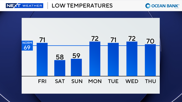
The coldest air of the season will lead to lows falling to the upper 50s and low 60s by Saturday morning.
South Florida will enjoy a taste of winter. The last time we had lows fall below 60 degrees was back in March.
On Saturday afternoon highs will struggle to reach the low 70s with bright sunshine and a north wind of 10 to 15 miles per hour.
Gusts could reach 20 miles per hour.
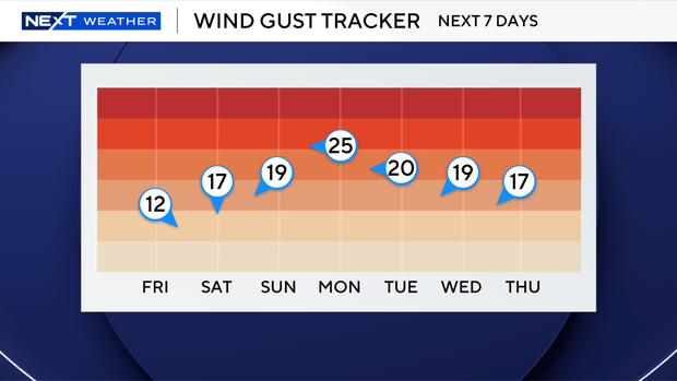
Still a bit of a chill Sunday morning with lows in the upper 50s and low 60s.
But highs will begin to creep up to the upper 70s under mostly sunny skies.
The breeze will be out of the northeast 10 to 15 miles per hour with gusts as high as 20 miles per hour.
Temperatures and rain chances increase early to middle of next week.
Highs will be near 80 degrees with passing showers Monday and Tuesday. Winds will be increasing with gusts near 30 miles per hour.