Showers ahead of a strong cold front, then a cool, dry weekend for South Florida

After showers work back into the area, a cold front will usher in the coolest air of the fall season this weekend, with a crisp morning chill and sunny, comfortable afternoons.
Wednesday remains warm, with highs in the lower to mid 80s. The CBS News Miami NEXT Weather rain tracker even sees the potential for scattered showers and thunderstorms as the sea breezes push inland this afternoon.
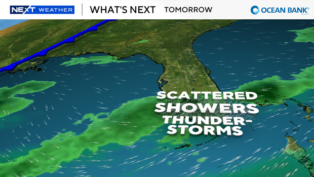
Most of the activity should focus on the interior and the east coast metro area. Those storms could produce gusty winds, frequent lightning, and heavy downpours.
On Thursday, highs will hold around 80 with more showers and storms throughout the day. A cold front moves through late Thursday night into Friday morning. Rain chances begin to diminish throughout the day before the cooler air arrives Friday night.
Behind the front, high pressure builds in from the northwest. Winds turn breezy, and cooler, drier air arrives by Saturday morning.
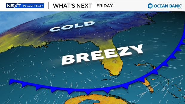
Lows could fall into the mid to upper 50s, while the immediate east coast stays in the lower 60s. That's right in line with the time of year South Florida typically sees its first lows below 60.
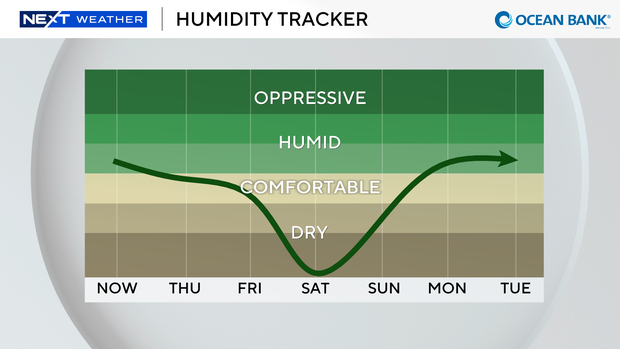
Humidity will drop right along with the temperatures. Dew points are expected to bottom out Saturday, and the air should feel dry by South Florida standards.
Saturday afternoon will be sunny and pleasant, with highs in the lower 70s. Sunday stays dry, and highs climb back to the mid to upper 70s, near 80 in some spots, as winds turn northeasterly.
The break may be brief. Forecast models hint at another disturbance moving along the northern Gulf Coast early next week, possibly spawning a low-pressure area that tracks toward Florida.
For now, the plan is simple: enjoy the weekend, and keep a light jacket handy for Saturday morning.