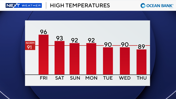
More record-breaking heat possible in South Florida on Friday before rain chances rise this weekend

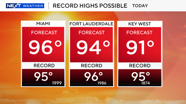
The final day of July will be sizzling in South Florida with record-breaking heat possible as high temperatures reach the mid- to upper 90s.
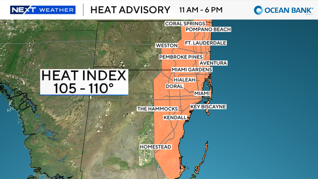
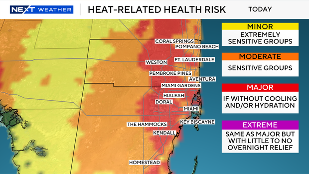
The National Weather Service has issued another heat advisory for Broward and Miami-Dade counties on Friday from 11 a.m. until 6 p.m. due to heat index values expected to reach 105 to 110 degrees when you factor in the humidity.
Friday morning has been mostly dry, but spotty storms will develop in the afternoon and evening.
If you are headed to the beach, there is a low risk of rip currents and the UV index is extreme.
There are no alerts or advisories for boaters over the Atlantic waters and the Keys.
This weekend is looking wetter with higher rain chances and the potential for scattered storms.
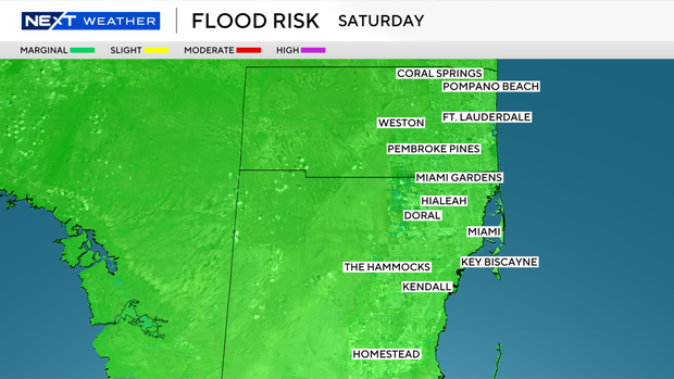
The Weather Prediction Center has placed South Florida under a level 1 out of 4 risk of excessive heavy rainfall because some storms may produce heavy downpours and lead to localized flooding in spots.
We remain unsettled Sunday with storms expected to develop around midday through the afternoon and evening.
The chance of rain remains elevated as we head into next week and kick off the month of August.
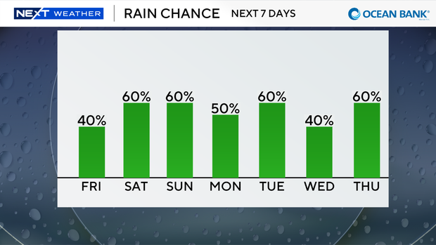
Scattered storms likely every day.
It will not be quite as hot with highs closer to the low 90s.