Tropical wave approaching South Florida leads to increasing rain chances this weekend

Keep the umbrellas handy this weekend as the chance of showers and thunderstorms is rising due to a tropical wave approaching South Florida.
On Friday morning, we woke up to passing showers, and scattered thunderstorms are possible on Friday afternoon and evening.
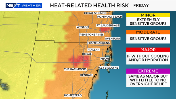
High temperatures will climb into the low 90s on Friday afternoon, but it will feel like 100 degrees when you factor in the humidity.
There is a moderate to major risk of heat-related illness in South Florida, which means there is a risk of heat exhaustion or heat illness for sensitive groups and for residents who are not properly cooling and/or hydrating.
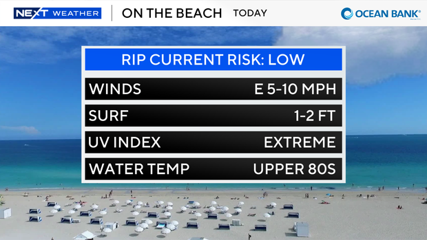
If you're headed to the beach to beat the heat, there is a low risk of rip currents, but the UV index will be extreme.
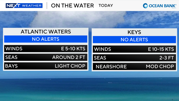
There are currently no alerts for boaters over the Atlantic waters or Keys waters.
The chance of rain is higher on Saturday and especially Sunday as winds shift out of the west and southwest, which will focus the storms over the east coast of South Florida.
A few showers will develop on both mornings, but most of the storms will fire up around midday, during the afternoon and into the evening.
Thunderstorms will likely be more widespread on Sunday with the potential of seeing heavy downpours.
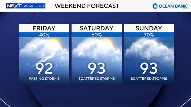
High temperatures will remain in the low 90s, and heat indices will stay in the triple-digits.
The beneficial rain will provide some relief from the oppressive heat, and will also help with our rain deficit.
The latest Drought Monitor indicates extreme drought has increased by 4% in Broward County and increased by 12% in Miami-Dade County.
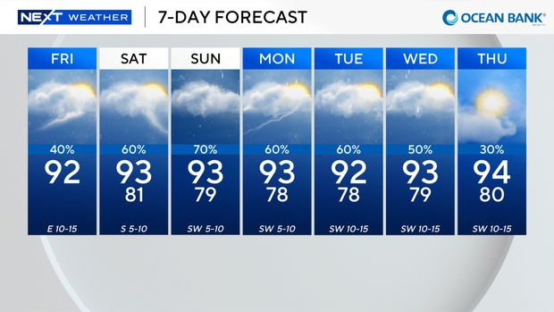
We remain unsettled with high rain chances through early next week.
In the tropics, Bertha has dissipated into a remnant area of low pressure and no other tropical systems are expected over the next 7 days.