Toasty Tuesday afternoon expected as Tropical Storm Bertha moves further from South Florida

The CBS News Miami NEXT Weather team is tracking a hot and mostly dry Tuesday as Tropical Storm Bertha continues to move further away from South Florida.
A warm morning will lead to a toasty afternoon with highs in the lower to mid-90s, but "feels-like" temperatures will range from 100 to 106.
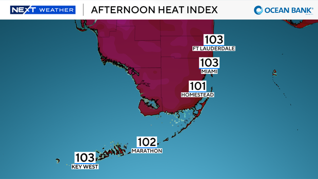
Despite the triple-digit heat, the air will be drier and conditions won't feel as steamy.
We are expected to remain below heat advisory criteria on Tuesday.
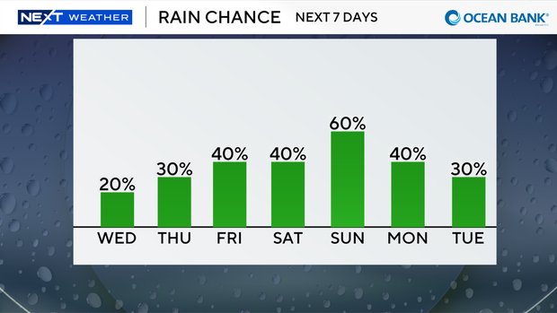
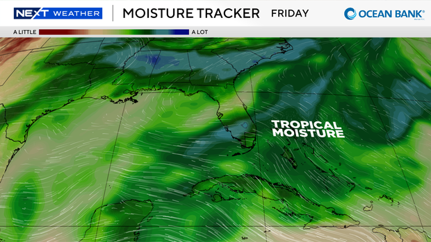
While stray morning showers will be possible on Wednesday morning, significant rain chances won't return until the end of the workweek into the weekend as tropical moisture moves in from the east.
This moisture is not associated with Tropical Storm Bertha, which is currently located in the northern Gulf and is moving northwest before turning west throughout the rest of the week.
The Tuesday morning update from the National Hurricane Center shows Bertha weakening throughout the week as drier air interacts with it.
Tropical storm warnings and watches currently extend along the Gulf Coast from the Florida Panhandle to Louisiana.
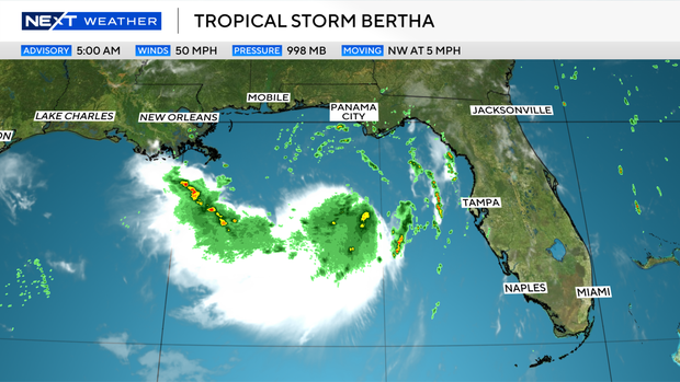
While tropical rain will be possible along the Gulf Coast, the heaviest rainfall is expected to stay out over Gulf waters.
South Florida will not receive any impacts from this system.
Steamier and wetter conditions return for the end of the workweek and weekend, potentially bringing the return of heat alerts back to South Florida along with scattered showers and storms.