South Florida sees minor flood threat due to risk of heavy downpours on Friday

Passing showers and thunderstorms are possible on Friday, but we'll start to transition to a drier weather pattern heading into the final weekend before the new school year starts in South Florida.
A few showers moved in across parts of Broward and Miami-Dade on Friday morning. The Weather Prediction Center placed South Florida in a level 1 risk of isolated heavy downpours on Friday.
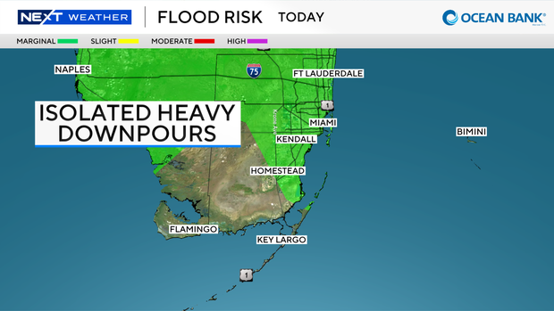
Although the wet weather on Friday won't be as widespread as the past few days, some storms may produce heavy rain and localized flooding.
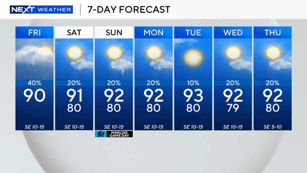
High temperatures will climb to around 90 degrees on Friday, and it will feel like the upper 90s and 100s when you factor in the humidity.
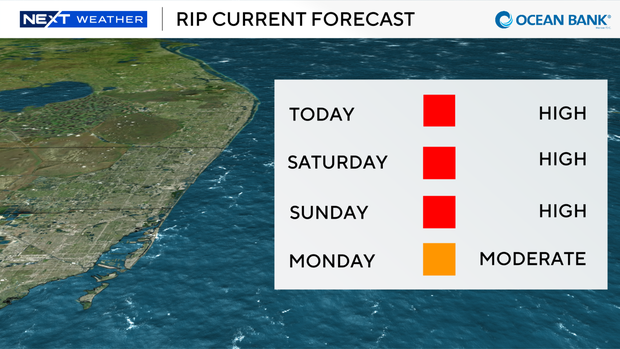
Breezy onshore winds will keep a dangerous high risk of rip currents along the Atlantic beaches through at least Saturday and possibly into Sunday.
The National Weather Service warns, "When in doubt, don't go out."
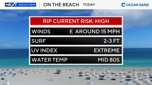
Residents are urged to pay attention to the flags at lifeguard stations and beach entrances.
If you see a red flag, it's not safe to go swimming in the ocean.
There are no alerts or advisories for boaters over the Atlantic waters or Keys waters.
Drier air will move in and lower rain chances for Saturday and Sunday. There is only a 20% chance of spotty showers or a few storms on Saturday and Sunday.

High temperatures will rise to the lower 90s, and it will feel like the triple digits.
The chance of rain stays low as Broward County students head back to school on Monday. It will be hot and humid with highs in the low 90s.
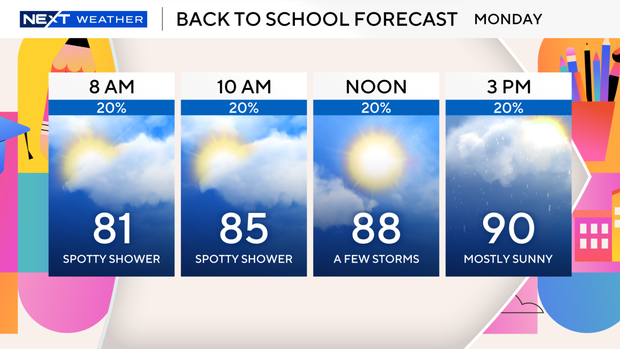
It will be even drier and hotter on Tuesday. Spotty showers will be possible next Wednesday and Thursday when Monroe County and Miami-Dade students head back to school, but rain chances stay low.