South Florida sees warm start to Thursday with scattered storms before lower rain chances this weekend

Scattered showers and thunderstorms will sweep into South Florida on the breeze on Thursday with the chances of rain highest in the morning through the midday hours.
In those passing showers and storms, some heavy downpours and gusty winds will be possible.
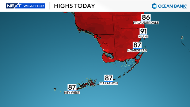
Another hot and steamy day is ahead with high temperatures in the low 90s in the afternoon. It will feel closer to the triple digits when you factor in the humidity.
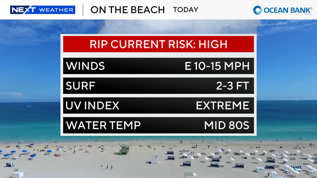
The strong onshore breeze is leading to a dangerous high risk of rip currents along our Atlantic beaches today through Saturday, so it won't be safe to swim in the ocean.
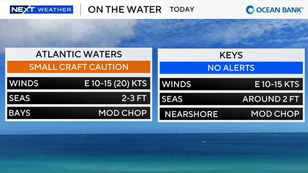
The gusty breeze is also leading to hazardous boating conditions. Small craft should exercise caution over the Atlantic waters. There are no alerts or advisories for boaters over the Keys waters.
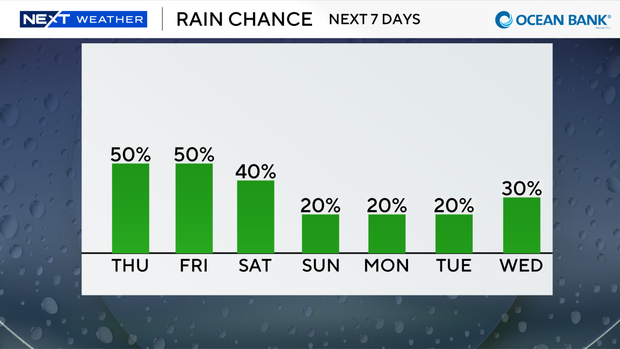
On Thursday night and Friday morning, we can expect another round of rain. The chance of rain stays high due to plenty of moisture around, but it won't be a complete washout.
Most of the showers and storms will be around in the morning through early afternoon.
The east wind will steer much of the wet weather inland and toward the west coast later in the day. High temperatures will remain seasonably hot in the low 90s.
Drier air then moves in over the weekend to lower our rain chances.
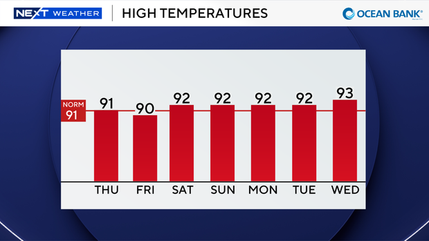
Passing storms will be possible Saturday, and spotty storms are possible Sunday with high temperatures in the low 90s.
Saharan dust will keep rain chances low through early next week as kids head back to school and everyone gets back to routine.