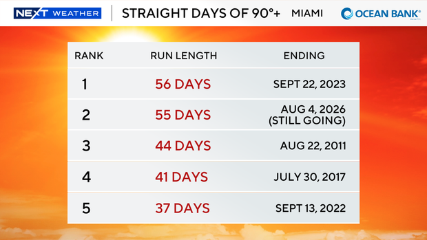
South Florida close to tying most straight days with temperatures above 90 degrees

Another round of wet weather moved across South Florida on Wednesday, but most of the activity will roll through the area during the first half of the day.
The change in the timing is due to a shift in the winds more out of the east.
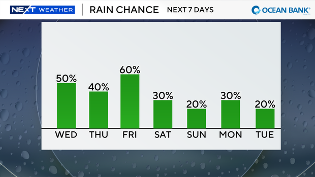
That onshore flow is helping to steer some showers and storms across east coast metro areas on Wednesday morning and likely through the midday hours.
On Wednesday afternoon, more of the storms will move inland and toward the west coast of the Florida Peninsula.
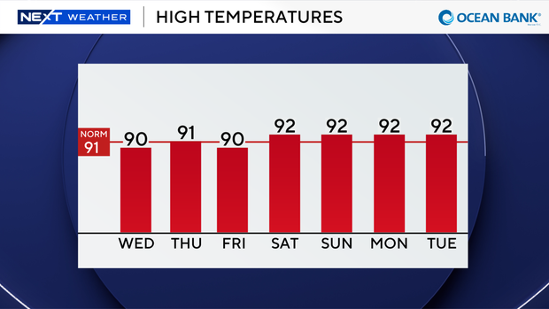
A hot and humid afternoon is ahead with high temperatures climbing to around 90 degrees. The CBS News Miami NEXT Weather team is forecasting a high temperature of 90 degrees in Miami.
If that verifies, we will tie a record streak of 56 straight days with high temperatures reaching 90 degrees or above, which was set back in 2023.
When you factor in the humidity, it will feel like the triple digits.
There is a moderate risk of rip currents along our Atlantic beaches, and the UV index will be very high. There are no alerts or advisories for boaters over the Atlantic waters or Keys waters.
Rinse and repeat on Thursday since the east and southeast breeze will continue to bring in scattered showers and storms in the morning before most of the action fires up over the interior and Gulf coast in the afternoon. High temperatures will remain seasonably hot in the low 90s.
More of the same is expected on Friday with scattered showers and thunderstorms expected.
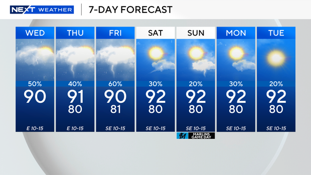
Drier air moves in over the weekend to lower the chances of rain.
A few showers and spotty storms will be possible on Saturday and Sunday.
High temperatures will stay in the low 90s with heat indices in the 100s.