Heat advisory in effect across South Florida on Friday due to potentially dangerous temperatures

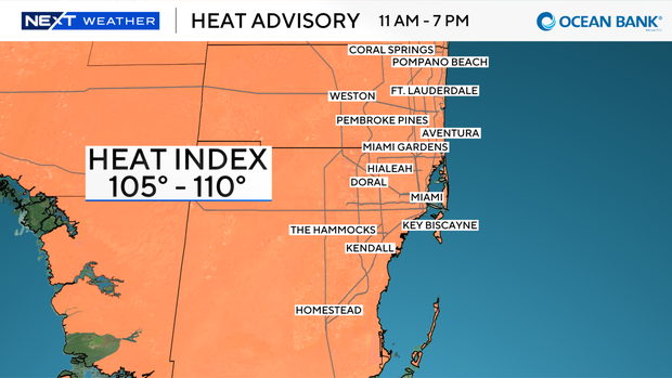
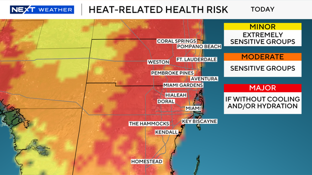
We're wrapping up the first week of the new school year with another heat advisory in South Florida, which will be in effect from 11 a.m. to 7 p.m. Friday due to the heat index values of 105 to 110 degrees.
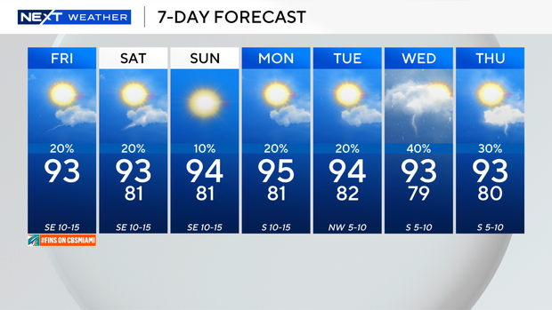
High temperatures will soar into the low 90s this afternoon, and it will stay mainly dry with only a few showers and isolated thunderstorms possible.
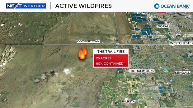
There is an active wildfire in western Miami-Dade south of Tamiami Trail and near Krome Avenue called the "Trail Fire."
It has burned around 25 acres and is 80% contained.
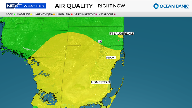
The air quality was moderate across much of Miami-Dade County on Friday morning. The southeast breeze is expected to help to steer much of the smoke towards the interior and west later on Friday.
Saharan dust will also be moving in and that will lead to hazy skies at times later on Friday and through the weekend. That could impact air quality in South Florida as well.
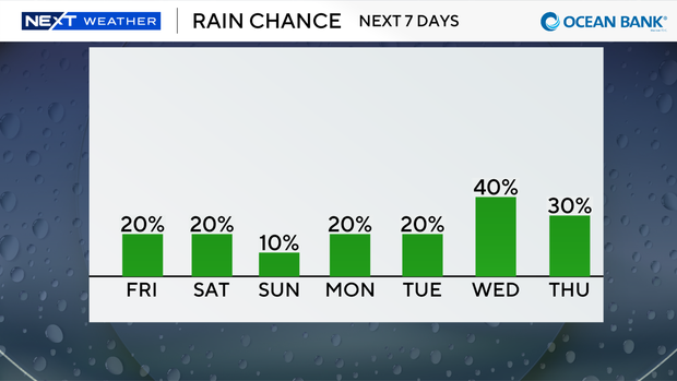
The drier air associated with the Saharan dust will keep the chance of rain lower on Friday, Saturday and Sunday. High temperatures will stay above average in the low 90s on Saturday, but it will be even hotter Sunday into Monday with high temperatures near the mid-90s.
The chance of rain will rise by the middle of next week.
The CBS News Miami NEXT Weather team is tracking two waves in the Atlantic.
The first wave in the Central Atlantic now has a low chance of development.
As this system moves into a hostile environment with strong wind shear and dry air, the chance of it developing into a tropical depression is decreasing.
Regardless of development, this wave will likely bring gusty winds and some heavy rain possible across the Lesser Antilles later Friday into Saturday.
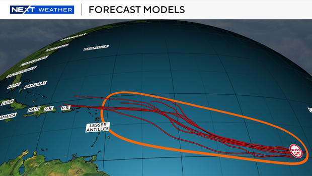
Another tropical wave located in the eastern Atlantic several hundred miles southwest of the Cabo Verde Islands is producing disorganized showers and storms.
The National Hurricane Center says environmental conditions are forecast to be conducive for gradual development and this system has a medium potential of developing into a depression this weekend as it moves westward.