South Florida students to see steamy start to new school year this week

Monday is the first day of school for Broward County students, and it's expected to be a hot and humid day ahead with low rain chances.
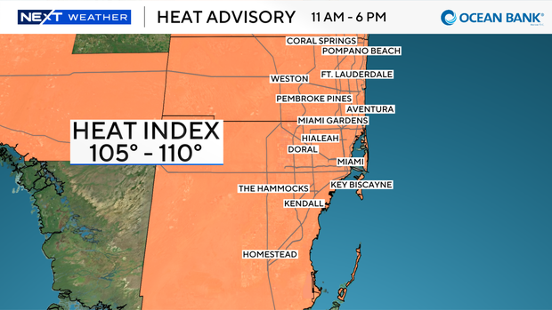
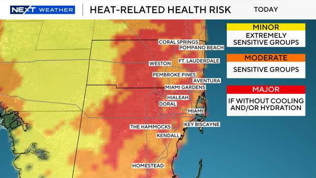
A heat advisory is in effect from 11 a.m. until 6 p.m. for Broward and Miami-Dade due to the heat index values of 105-110 degrees.
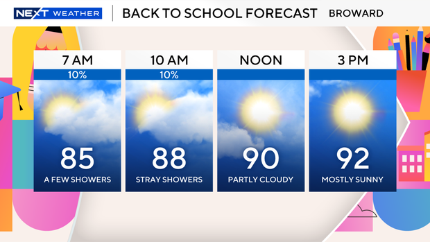
It's already a warm, steamy start with a few showers blowing in on the breeze.
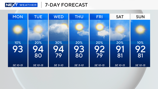
It will be mostly sunny on Monday afternoon with high temperatures in the low 90s.
There is a moderate risk of rip currents along the Atlantic beaches. There are no alerts or advisories for boaters over the Atlantic waters or Keys waters.
Another scorcher is expected on Tuesday with high temperatures soaring into the low 90s, and it will feel like it's in the triple digits.
Spotty showers will be possible, and the chance of rain will increase on Wednesday with the potential for passing showers.
High temperatures will remain above average through late week.
It won't be quite as hot this weekend, but more seasonable with high temperatures closer to 90 degrees.
The CBS News Miami NEXT Weather team is tracking three areas in the Atlantic.
An area of low pressure in the eastern Atlantic located a few hundred miles south of the Cabo Verde Islands has medium potential, a 60% chance, of development over the next seven days.
Environmental conditions are forecast to become more conducive for development by midweek as this system moves slowly westward across the Atlantic and it may become a tropical depression during the latter half of the week.
In the central Atlantic, a tropical wave midway between the coast of Africa and the Lesser Antilles has a low potential, a 10% chance, of development over the next seven days.
And in the western subtropical Atlantic, a trough of low pressure located a few hundred miles northwest of Bermuda has a low potential, a 10% chance, of formation over the next seven days and is expected to move eastward away from the U.S.