More rounds of heavy rain, thunderstorms could lead to wet Wednesday in South Florida

The NEXT Weather Team is tracking a potentially wet Wednesday across South Florida as more rounds of rain are on the way.
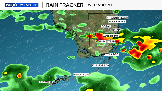
While a few scattered showers were possible for the morning, the highest rain chances arrive for the late afternoon and evening as a weak cold front slowly moves in from the north.
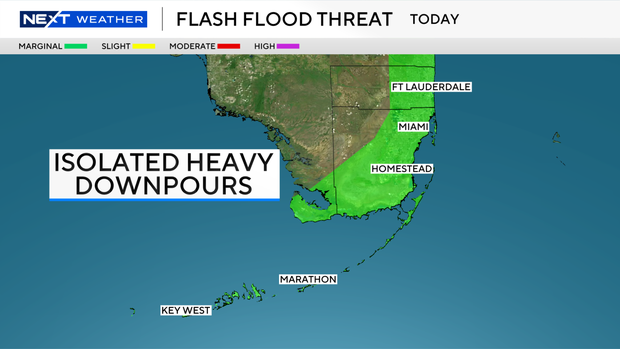
Within these widespread showers and storms, a few isolated heavy downpours will be possible.
There is a marginal – level 1 out of 4 – risk for flooding across the metro areas of Broward and Miami-Dade along with the Keys on Wednesday.
It is worth noting that forecast models are not in agreement as to how much rain we will receive on Wednesday.
On the lower end, some models show widespread totals up to an inch with isolated pockets up to 2 inches.
On the heavier side, some models hint at isolated pockets picking up as much as 3-5 inches.
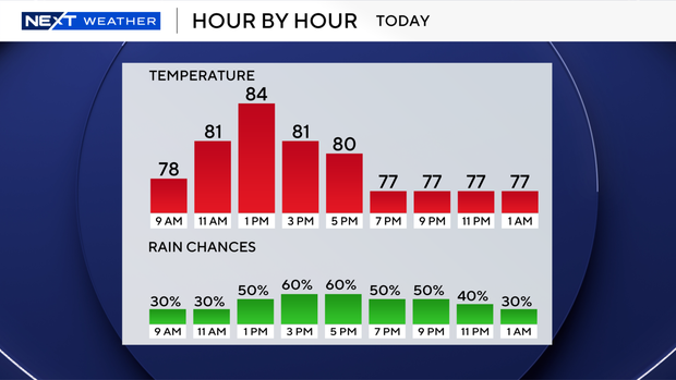
Due to the combination of rain and cloud coverage, afternoon highs will trend roughly 10 degrees cooler for the afternoon as highs peak in the mid-80s in Broward and Miami-Dade.
This comes after record-breaking heat in Miami on Tuesday when highs reached the mid-90s.
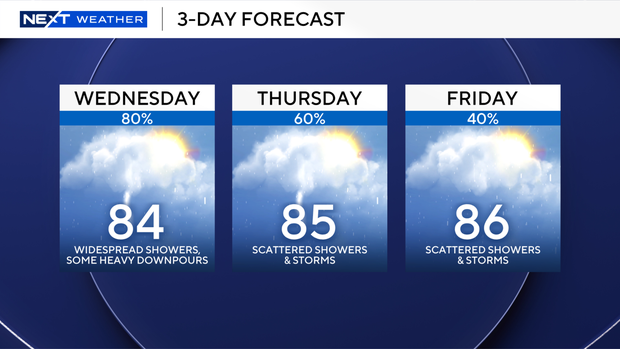
Scattered to widespread rain chances linger in the forecast for the rest of the workweek and lower for the upcoming weekend to roughly 30% both Saturday and Sunday.
Another wet weather pattern could be on the way for next week, but our team will continue to iron out those details over the coming days.