More showers, storms possible in South Florida as triple-digit feels like temperatures linger

The NEXT Weather Team is tracking another round of scattered showers and storms for Tuesday afternoon as triple-digit "feels-like" temperatures linger in the forecast.
After a wet start to the workweek on Monday, more storms are expected to develop, mostly between 1 p.m. and 5 p.m. on Tuesday for Miami-Dade and Broward counties.
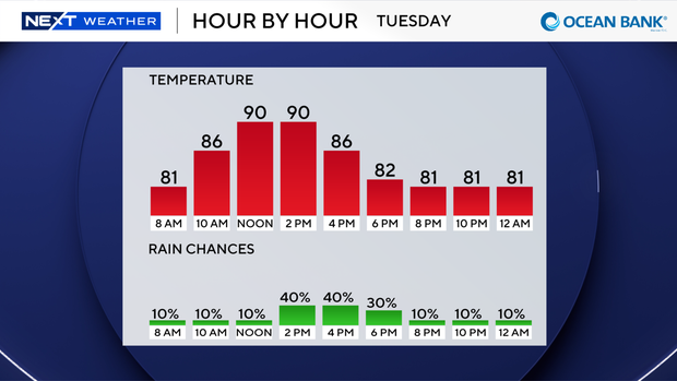
While an isolated storm will still be possible around dinnertime, showers fizzle out by the overnight hours before additional showers develop on Wednesday.
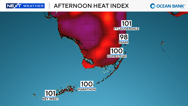
Ahead of the rain, afternoon highs make it to the lower 90s with "feels like" temperatures up to 110 possible.
Forecast models show the possibility of a few scattered showers and storms on Wednesday morning through early afternoon.
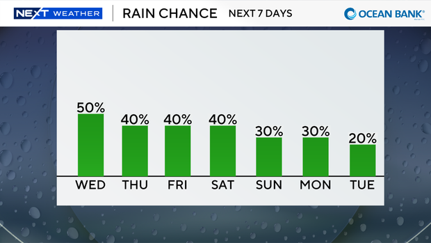
Rain chances will remain scattered each afternoon but will start to favor inland areas as winds shift out of the east later in the workweek.
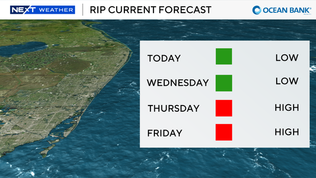
This shift in the wind will also start to increase our rip current risk at the coast.
A high rip current risk returns on Thursday and could potentially linger through the upcoming weekend.