South Florida stuck in gloomy weather pattern, cool change is on the way

MIAMI - South Florida is stuck in a gloomy weather pattern again on Thursday.
A chilly northwest breeze at the surface will keep temperatures cool in the upper 50s and lower 60s while moisture moves in from the south above that. This will keep clouds around along with a lower chance of showers. Misty light rain showers are possible at any time of day with some partial clearing to the south over the Keys and southern Miami-Dade.
A breeze from the north is keeping the seas rough. A small craft advisory remains in effect for the Atlantic coastal waters while small craft should use caution in the Keys.
Friday will see drier air move in as the skies clear throughout the day. Despite more sunshine, temperatures will actually fall as the northwest wind brings the cold arctic air across the southeast down the Florida Peninsula into the area at night. Saturday morning will see sunshine but cold temperatures with lows dipping into the upper 40s. With the breeze it will feel like it is near 40 degrees.
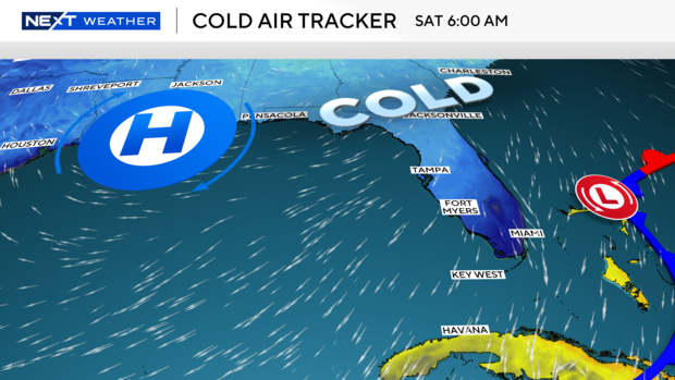
The NEXT Weather team will continue to monitor the cold weather alerts being issued just to our north should they expand into South Florida. For now, the alert is issued for wind chills down to about 30 degrees which is not expected here in Broward or Miami-Dade.
By the end of the weekend, the chilly breeze shifts back to the east which will bring milder air back into South Florida on Sunday night. Lows will be back above 60 degrees as highs push up to near 80 degrees.


