More flooding possible in South Florida as additional rounds of showers, storms roll through


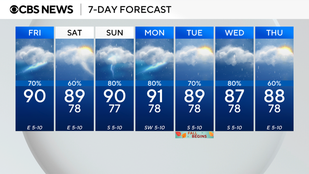
Get ready, South Florida. It's going to be a wet and stormy weekend.
Some showers and thunderstorms moved into the region early Friday morning, and that led to some more reports of flooding in spots.
A ground stop was lifted at Fort Lauderdale-Hollywood International Airport, after it was issued due to the stormy weather Friday afternoon.
More rounds of storms popped up in the afternoon, and that led to forecasters issuing a flood advisory for parts of Broward County until 5:30 p.m.
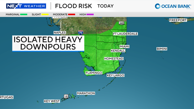
This flood advisory includes communities like Parkland and Coral Springs. Rainfall totals have reached 2 to 4 inches in some spots, with 1 to 2 more inches still possible.
Because of that, the Weather Prediction Center placed South Florida in a Level 1, or a marginal risk, of excessive heavy rainfall. It won't be as hot on Friday as it has been due to the clouds and wet weather.
Forecasters say conditions should improve enough by 7 p.m. to scale back weather alerts, though that timeline could shift depending on how quickly the storms move out.
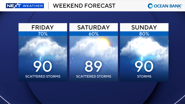
The high temperatures are expected to climb into the upper 80s.
An area of low pressure in the upper levels of the atmosphere will keep the chance of rain high through the weekend with scattered showers and thunderstorms on Saturday and Sunday.
High temperatures will remain in the upper 80s.
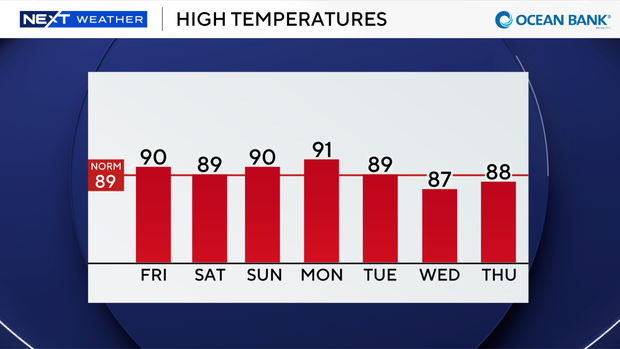
Deeper tropical moisture will enhance the potential for more widespread storms early to middle of next week with even higher rain chances.
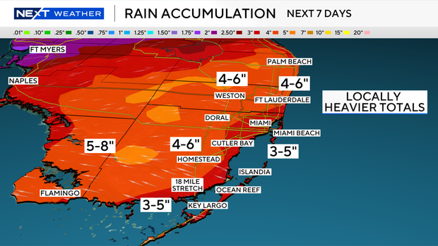
We may see rainfall totals of 3 to 5 inches and isolated amounts of up to 6 inches through the next 7 days. This will be the wettest pattern of the season so far.
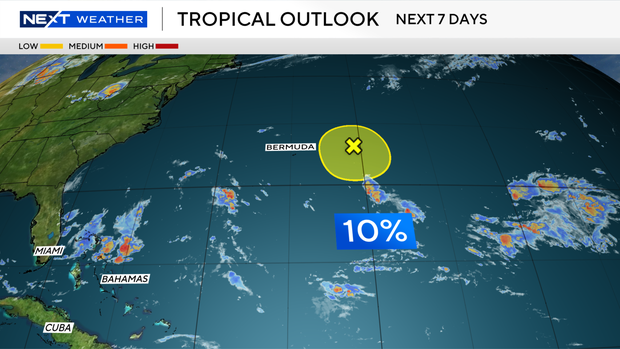
In the tropics, the CBS News Miami NEXT Weather team is tracking an area of low pressure located in the Atlantic a few hundred miles east of Bermuda with a low potential of development.
The National Hurricane Center says development of this system is unlikely as it moves westward.
Today marks 100 years since the Great Miami Hurricane made landfall as a Category 4 here in South Florida.