Tornado warning in Broward County as cold front to bring rain and storms throughout South Florida Saturday afternoon
MIAMI — After a mainly dry and breezy start to our Saturday, a cold front will bring a line of rain and storms through South Florida beginning mid-afternoon into the evening hours.
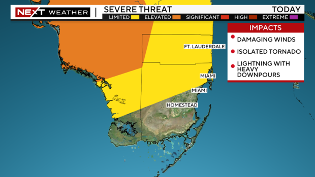
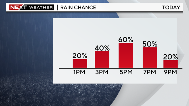
The main time frame for rain and storms will be from 2 p.m. to 9 p.m. Saturday. During that time, an isolated strong to severe storm will be possible. The main threat from any thunderstorms that do develop will be damaging winds, but an isolated tornado cannot be ruled out.
Around 5:45 p.m., a tornado warning was issued for Fort Lauderdale, Wilton Manors and Port Everglades after CBS News Miami's NEXT Weather Radar picked up on a wind rotation near those areas. Though the warning is only in effect until 6 p.m., please stay indoors through Saturday night.
While the severe threat will be diminishing overnight, a few showers and storms will remain possible into Sunday morning. With the front stalling near South Florida through Sunday, expect ongoing spotty showers and a mostly cloudy sky to round out the weekend.