Strong winds, lake-effect snow in Michigan's forecast for Wednesday

Winter weather is in the forecast for the Great Lakes region as Thanksgiving holiday travel ramps up.
Wednesday's issues are not dependent on one single weather type, but due to a combination of several.
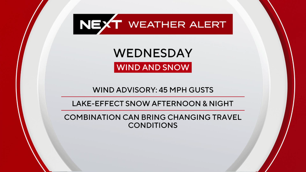
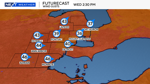
Wind gusts will ramp up through the morning, reaching peak strength in the afternoon and evening hours. Wind gusts will likely be near the 40 to 50 mph range at this time, and that poses a few issues on its own.
First and foremost, for those travelling, higher-profile vehicles will have a tricky time on north-south roads.
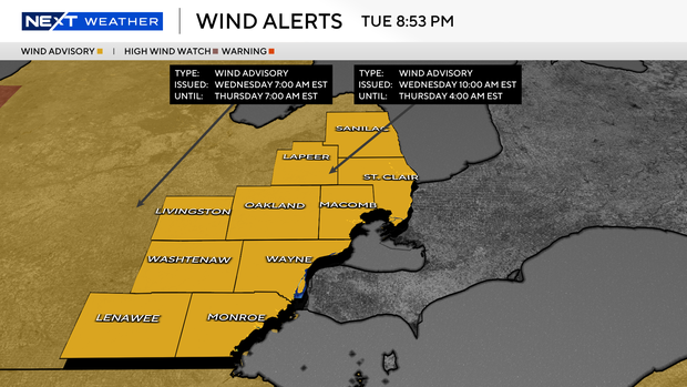
Snow showers later will also lower visibility due to the wind. Wind advisories are in effect from 10 a.m. on Wednesday through 4 a.m. on Thursday.
Working at the same time as the wind will be our lake-effect snowfall.
Snow showers will begin on the west side of the state during the morning hours on Wednesday before swinging into Southeast Michigan in the afternoon. Our accumulation amounts are more likely at night, and mainly range around 1 to 2 inches at most.
The most likely areas would be between I-696 and I-94, along with areas north of Intersection 69, where lake-effect snow showers are most likely to line up from west to east across the state.
If you are travelling to areas west of US-127, plan now for tricky travel on Wednesday, especially in the latter half of the day. Travel to the Upper Peninsula will also become more difficult as blizzard conditions are likely the farther west of Munising you go.
If your Thanksgiving travel plans include northern Ohio, the Ohio Turnpike (I-80/90) has issued a travel alert effective 8 a.m. Wednesday through 11:59 p.m. Thursday that prohibits high-profile vehicles such as mobile homes and many large vehicles from travelling on the toll road.
Stay with the NEXT Weather team for updates as colder air and wind arrive.